
Ometepe Island
"Ometepe reminds you that islands made by fire tend to hold the most life."
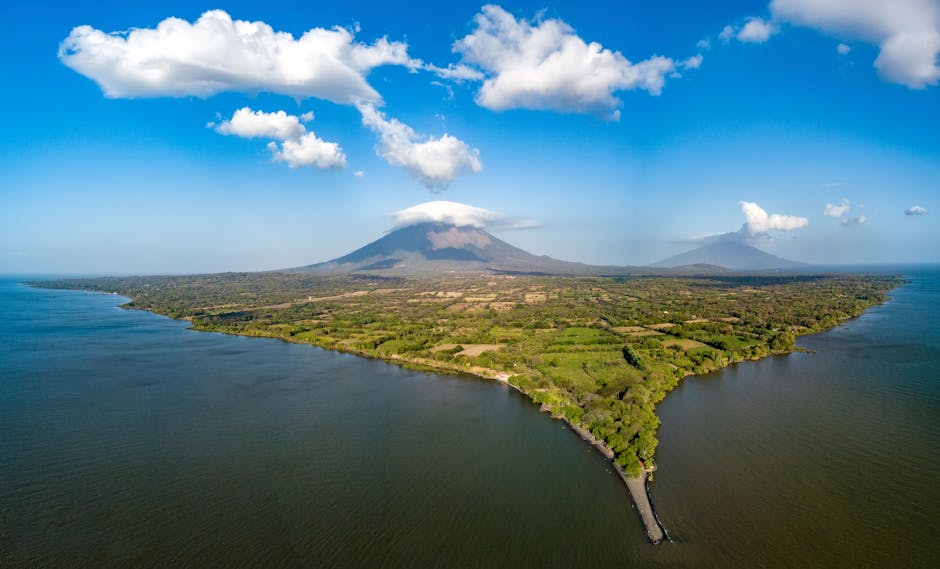
Two volcanoes rise from Lake Nicaragua forming an island that Nahuatl speakers called the place of two mountains.
The ferry from San Jorge takes about an hour, long enough to watch the two volcanoes grow from suggestions on the horizon into something that commands the entire sky. Concepción on the left — symmetrical, still active, trailing a faint plume on clear mornings — and Maderas on the right, older and quieter, its crater holding a lagoon at the top that you can only reach through four hours of root-tangled cloud forest. They are joined at a narrow isthmus, and the whole shape of the island reads from the water like a figure eight drawn by someone who wanted to get it exactly right.
Moyogalpa and the Smell of Wet Soil
The main port town, Moyogalpa, is not much: a grid of streets, painted concrete storefronts, a few hospedajes where ceiling fans work harder than the air conditioning in places twice the price. We ate our first meal at a comedor with no sign on Calle Principal — a plate of gallo pinto with two fried eggs and a cup of pinolillo, the toasted corn-and-cocoa drink that Nicaragua drinks the way France drinks coffee. The pinolillo arrived warm and grainy and faintly sweet, and I drank two cups before Lia had finished her first.
What I remember most from that first morning is the smell: the lake, which carries a mineral cold even when the sun is already high, mixing with the black volcanic soil that holds moisture long after the rain stops. The whole island smells like something recently extinguished.
Climbing Concepción
The trail to the summit of Concepción begins near the village of La Concha and climbs without mercy. At the lower elevations, the path passes through fields of plantain and cacao. Higher up, the vegetation compresses — shorter, windier — and then disappears entirely into a zone of ash and bare rock where the crater breathes sulfur and the visibility drops to ten meters. We turned back before the summit, as most people do. The guide, a man named Emiliano who had made the climb two hundred times and seemed equally comfortable in either direction, said this without any judgment at all.
The unexpected thing was the descent, not the ascent: the way the lake reappeared through breaks in the cloud as we came back down, flat and silver-grey, enormous — at 8,000 square kilometers, the tenth-largest freshwater lake in the world — and the volcanoes of the mainland visible across it as a long dark line. The island felt, in that moment, genuinely remote in the way that very few places still do.
Playa Santo Domingo and the Petroglyphs
The isthmus between the two volcanoes holds the island’s longest beach, Playa Santo Domingo — a black-sand strip that the lake pushes waves against, small but actual waves, which surprises everyone who arrives expecting stillness. Lia and I spent an afternoon there watching horses graze the edge of the water, the peaks of both volcanoes visible from a single blanket, which is one of those things that should not be possible on any island this small.
The petroglyphs scattered across Ometepe — carved into boulders by the people who lived here before the Nahuatl speakers who gave the island its name — are easy to walk past without noticing. The largest collection sits near the community of Altagracia, beside a road that seems designed to discourage visitors. We stopped at one boulder that bore a spiral and what looked like a jaguar, though the guide books hedge on the interpretation. I spent longer in front of it than I expected to, aware of the gap between looking and understanding, and the fact that sometimes looking is enough.
When to go: November through April, when the dry season holds and the trails are passable. February and March bring the clearest views of both summits — the rains arrive in May and don’t fully leave until October.