Annapurna Circuit
"You walk for twelve days and the mountain is always there, rotating slowly around you like it owns the sky."
The Annapurna Circuit is not the secret it once was. Roads have eaten into both ends of the classic route, shortening it from three weeks to twelve or fourteen days if you start at Besisahar and finish at Jomsom. Teahouses have Wi-Fi. Some sections have lost the isolation that made the old accounts sound mythological. And yet. The route still crosses Thorong La at 5,416 meters, still drops into the Mustang rain shadow where the landscape turns red-brown and Tibetan, still walks through the Kali Gandaki Gorge — arguably the deepest gorge on earth, where Annapurna and Dhaulagiri rise 6,000 meters from the river floor. The infrastructure improvements didn’t change the physics of the place.
The Lower Circuit: Marshyangdi River Gorge
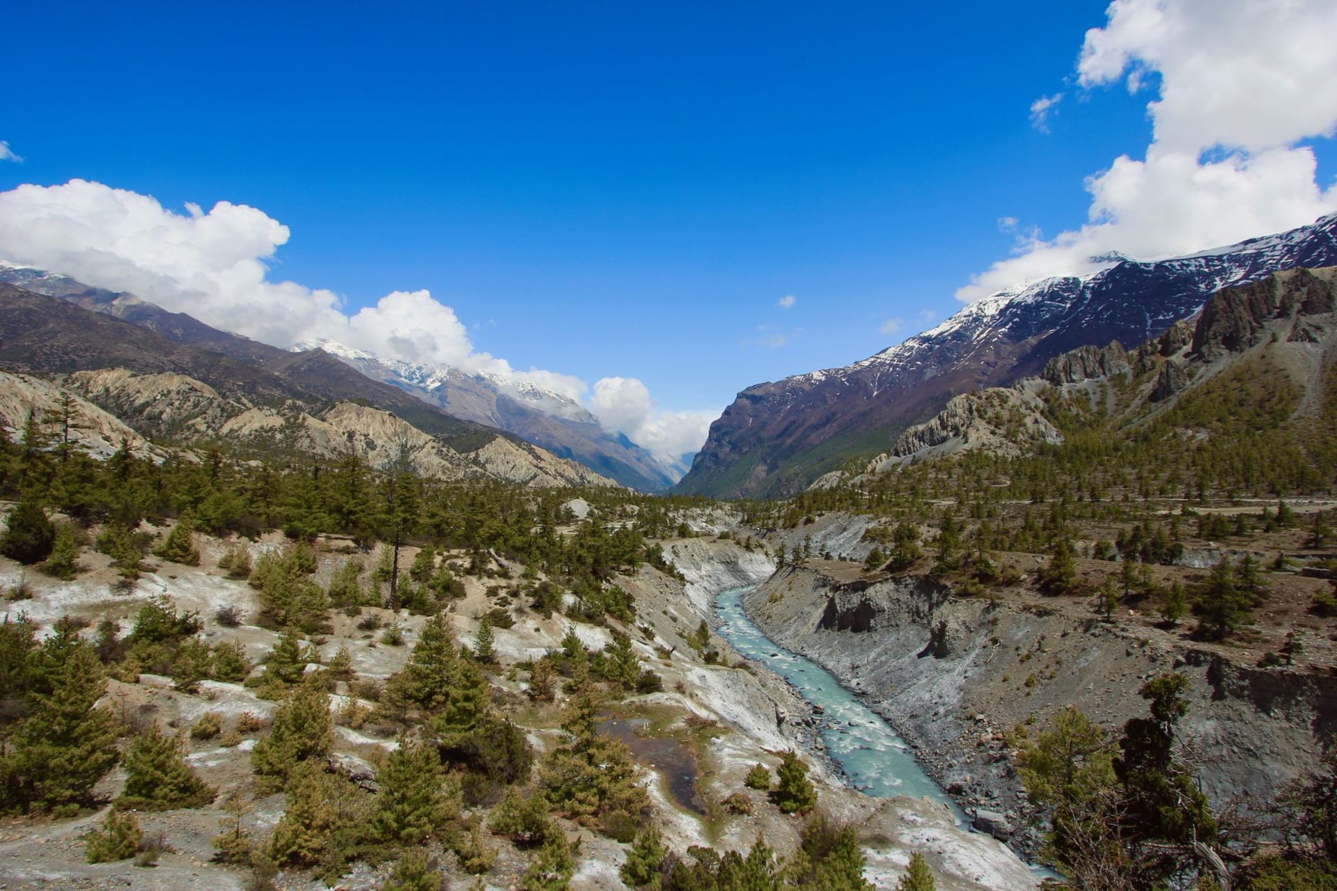
The first three days follow the Marshyangdi River into the Himalayas, gaining altitude gradually through villages where the architecture shifts from Gurung to Manang to Tibetan as you climb. Chamje, Tal, Chame — each teahouse has a wood stove, a menu laminated in plastic, and a view that improves with every 200 meters. The forests here are dense: oak, pine, rhododendron. In the mornings the mist sits low in the valley and the river sounds like static.
I ate my first plate of apple pie at a teahouse in Pisang — the Manang valley produces apples, improbably, and the pie tastes like it’s been made by someone who learned the recipe once and has improved it over forty seasons. It’s a small thing but the Annapurna Circuit runs on small things: the right tea at the right altitude, a room with a window facing the right peak.
Manang and the Acclimatization Day
Manang at 3,519 meters is where you stop and adapt. The acclimatization hike up to Gangapurna Lake is mandatory in the informal sense — your body needs the elevation before Thorong La and the lake is worth it regardless. The water is glacial turquoise, which is a color that photographs lie about. In person it’s stranger and darker, more like something industrial than natural, the color of cold physics.
The altitude above Manang begins to thin the air in ways that affect your thinking. I noticed I was writing shorter sentences in my notebook. Everything became more literal. The mountains are big. The sky is dark blue. My lungs hurt when I walk fast. That kind of accurate.
Thorong La and the Mustang Side
The pass crossing begins at 4 AM because altitude weather closes in by midday and you don’t want to be on the ridge when it does. The last hour to the top is switchbacks on snow and ice, headlamp beams catching exhaled breath, and then a sign and prayer flags and a view that extends into the Tibetan plateau on one side and back over the Manang valley on the other. I cried a little, which I attribute entirely to the oxygen situation.
The descent to Muktinath is long and fast and you arrive into a different world — the Mustang rain shadow, where the landscape is suddenly dry and wind-scoured and the vegetation has given up. Muktinath’s temple complex burns eternal flames from natural gas seeps. The holy water is cold enough to stop your thinking. The tea afterward is the best tea you’ve ever had.
The remaining days through Kagbeni and down the Kali Gandaki to Jomsom feel like a proper ending: wind at your back, elevation dropping, Nilgiri’s north face watching from the right. The circuit closes into itself.
When to go: October through early November is the gold standard — post-monsoon clarity, moderate temperatures at altitude, dry trails. March through May is the second window with warmer nights and spring color on the lower slopes. Thorong La can close in winter and during heavy snowfall; always check conditions before attempting the pass.