El Pinacate
"I stood on the rim of a crater 1.5 kilometers wide and felt, not unpleasantly, like an ant on the edge of a coin."
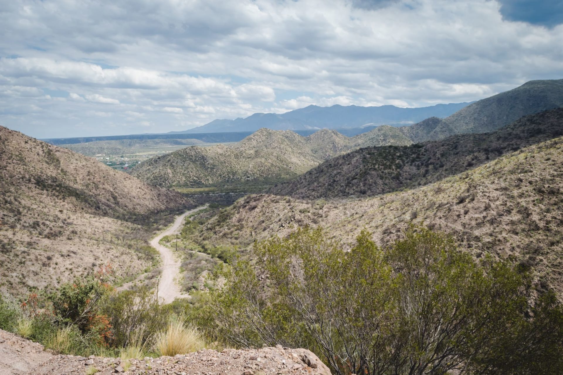
The road into El Pinacate begins near the town of Sonoyta, close to the Arizona border, and the landscape changes almost immediately. You leave the flat scrub of the border zone and enter something that has no comfortable precedent. Black lava flows extend across the desert floor like frozen rivers, the basalt broken into angular fragments that catch the light at odd angles. Cinder cones rise out of the flatness — small, almost conical, their redness and symmetry making them look less geological than they are, as if someone had placed them with intention.
I drove in at dawn because that was what the ranger at the entrance station had recommended, and because the heat in northwest Sonora in the early morning is merely intense rather than punishing. By ten a.m. the temperature was approaching forty degrees. By noon I was glad to be back in the car with the air conditioning doing its best.
The Craters and the Moon
El Pinacate’s volcanic shield is roughly 800,000 years old, the product of eruptions that produced some of the most varied volcanic landforms in North America. What makes the Pinacate famous — what got it on the UNESCO list and into the Apollo astronaut training program — are the maar craters: enormous circular depressions formed when magma hit groundwater and the resulting steam explosion blew out a hole in the earth. These are not the graceful bowl-shaped calderas you imagine when someone says volcanic crater. They are blunt, circular, raw. The largest of them, Elegante, is a kilometer across and three hundred meters deep.
Santa Clara, where I stopped first, is smaller but somehow more disorienting. Standing on the rim, the crater floor below you is a flat circle of sand and sparse desert vegetation that looks, at the right angle, genuinely lunar — grey-white, silent, without reference to scale. NASA sent Apollo astronauts here in the 1960s to practice traversing the landscape and collecting rock samples, and looking down into Santa Clara I understood the decision completely. There is nothing in this crater that would tell you which planet you’re on.
I stood there for twenty minutes. A group of vultures — black vultures, not turkey vultures, which I noted only because I’ve become slightly obsessed with Mexican vulture identification — were doing lazy spirals above the opposite rim. Nothing else moved. The silence was the kind that cities train you not to notice until you’re standing in the middle of it.

The Gran Desierto de Altar
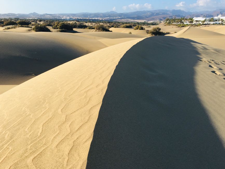
Adjacent to the volcanic zone — sharing the same biosphere reserve boundary — is the Gran Desierto de Altar, the largest active sand dune field in North America. Active means the dunes are still moving, pushed by wind into forms that rearrange themselves seasonally. Some of the dunes here are over 200 meters tall.
The juxtaposition is what you don’t expect and can’t fully prepare for: black volcanic rock on one side of the road, white sand dunes on the other, the Sea of Cortez glinting about sixty kilometers to the west on clear days. These are two of the most extreme landscapes in North America sharing a boundary in northwest Sonora, and there’s no particular reason why they should be beautiful together except that they are.
I stopped at a pullout where the dunes came close to the road and walked out into them for about twenty minutes. The sand was fine and pale and very hot even in the morning. The silence here was different from the crater silence — the dunes absorb sound in a way that the hard volcanic rock doesn’t, and the effect is a kind of acoustic softness, as if someone had turned down the world’s sharpness slightly.
Logistics and What You Need to Know
El Pinacate is genuinely remote. The nearest city is Sonoyta, a small border town with basic services. Puerto Peñasco (Rocky Point), the Sonoran beach resort about 60km west, has better hotels and restaurants and is the logical base for visiting the reserve. The reserve entrance requires a permit, issued at the entrance station; as of my visit, fees were nominal and the rangers were helpful with trail information.
There is almost no infrastructure inside the reserve — no restaurants, no services beyond a couple of basic pit toilets near the main crater overlooks. Bring water, far more than you think you need. The summer heat here is life-threatening; visit between November and March. A high-clearance vehicle is useful for the unpaved roads to the crater viewpoints, though a regular car can manage the main access road.
This is not a place you visit because it’s convenient. You visit because there is nowhere else in Mexico — nowhere else in North America — that looks like this. The craters are real and the dunes are real and the silence is real, and all of it is about two hours from the border.