Creel
"The Copper Canyon is four canyons. Each is larger than the Grand Canyon. Altogether they are six times the volume. The canyon walls turn copper in the afternoon light."
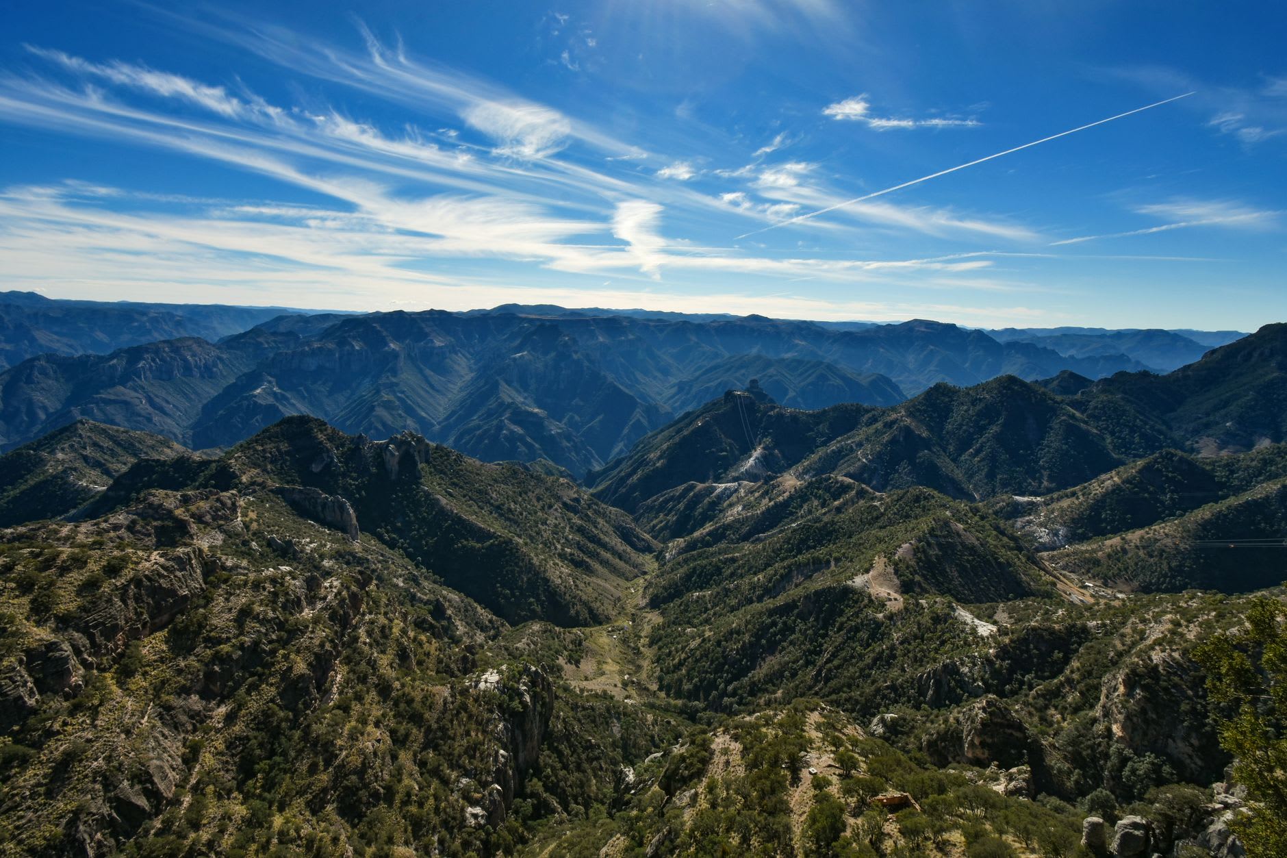
Creel is a logging and railroad town in the high pine forests of the Sierra Tarahumara at 2,338 meters, and it exists on the traveler’s map for one reason: it is the gateway to the Barranca del Cobre — the Copper Canyon system, which consists of four major canyons (Urique, Batopilas, Sinforosa, and Candameña) that together form a canyon complex six times the volume of the Grand Canyon in Arizona. The walls turn copper-colored in the afternoon light; the name is accurate.
The second reason to come to Creel: the Rarámuri (also called Tarahumara), the indigenous people who live in the canyon system and the surrounding mountains, renowned internationally for their long-distance running ability — the Rarámuri traditionally run distances of 150-300 kilometers in their mountain terrain, often in huarache sandals or barefoot, and have produced multiple ultramarathon champions in international competition.
The El Chepe Train
The Ferrocarril Chihuahua al Pacífico (known as El Chepe) is the rail line that connects the Pacific coast city of Los Mochis (Sinaloa) to the interior city of Chihuahua through 673 kilometers of the Sierra Madre Occidental — crossing 39 bridges and passing through 86 tunnels, gaining and losing 2,400 meters of elevation through the canyon system. It was completed in 1961 after 90 years of construction.
The train is the most practical way to experience the canyon’s depth — the line descends from the 2,400-meter plateau at Creel to the canyon floor at Barrancas (where the viewing point looks into the Urique Canyon) and then climbs and descends through the mountains to the Pacific coast. The classic itinerary: take El Chepe from Chihuahua or Los Mochis to Creel (full journey 15-16 hours), use Creel as a base for several days, continue on El Chepe to the coast or return to the interior.
The train now operates in two classes: the Express (tourist, reserved seating, on-time) and the Regional (local, slower, cheaper, stops at every village). The Regional is the more interesting ride.
The Canyons
From Creel, the canyon access points:
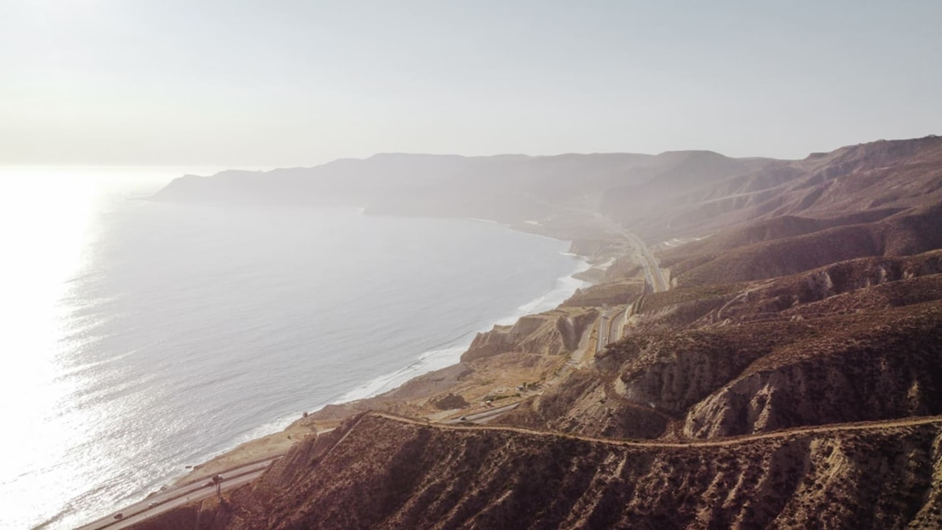
Divisadero (1 hour by road or El Chepe stop): the rim viewpoint above the Urique Canyon, where the canyon drops 1,870 meters to the river at the bottom. The view is the standard Copper Canyon photograph. The zip line across the canyon mouth is the most dramatic zip line in Mexico.
Batopilas (4 hours by dirt road, 1,800m descent): the canyon town at the bottom of the Batopilas Canyon, a colonial silver mining village that was once one of Mexico’s wealthiest towns and now has a population of 1,500 and a single paved street. The drive down is extreme; the town at the bottom is tropical (citrus trees, bougainvillea, a colonial church) while the rim is pine forest. The temperature difference is 20 degrees.
Valle de los Hongos: the mushroom-shaped rock formations 8 kilometers from Creel, accessible by walking or bicycle. The volcanic tuff erodes into forms that look like stacked discs.
The Rarámuri
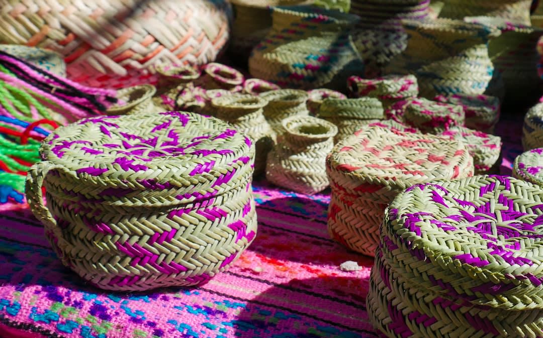
The Rarámuri communities live throughout the canyon system and the surrounding mountains, many in cave dwellings or small ranchos accessible only on foot or horseback. They sell crafts in Creel’s market: pine needle baskets woven with the natural and dyed needles of the local pines, wooden carvings, and violins (the Rarámuri adopted the violin from the Jesuits in the 17th century and developed their own tradition of violin music for the tutuguri ceremonial dances).
The Rarámuri’s relationship with tourism is complex; many communities prefer minimal contact and should be approached with the same respect as any indigenous community that has not asked to be a tourist attraction.
Getting there: El Chepe from Chihuahua city (7-8h) or Los Mochis (8-9h). Bus from Chihuahua to Creel (5h, cheaper but no canyon views). Most visitors combine El Chepe with a bus segment depending on direction.
When to go: April through October for the best weather (June-September brings afternoon rain but lush forest). November through March is cold at altitude (below freezing nights) but clear; the canyon walls photograph best in winter light.