
Sørvágsvatn
"I knew the photograph lied about the scale. I was wrong. The reality was stranger than the lie."
I had seen the photograph hundreds of times before I arrived. The lake floating above the ocean. The ridge that appears to hold the water at altitude while the sea crashes far below. I knew, intellectually, that it was a trick of perspective — that the lake sits only thirty meters above sea level, not the hundreds the image implies, and that the camera is positioned on a slope that compresses the foreground and makes everything look like what it is not. Knowing this did not prepare me, even slightly, for arriving at the edge of the ridge and looking at it with my own eyes.
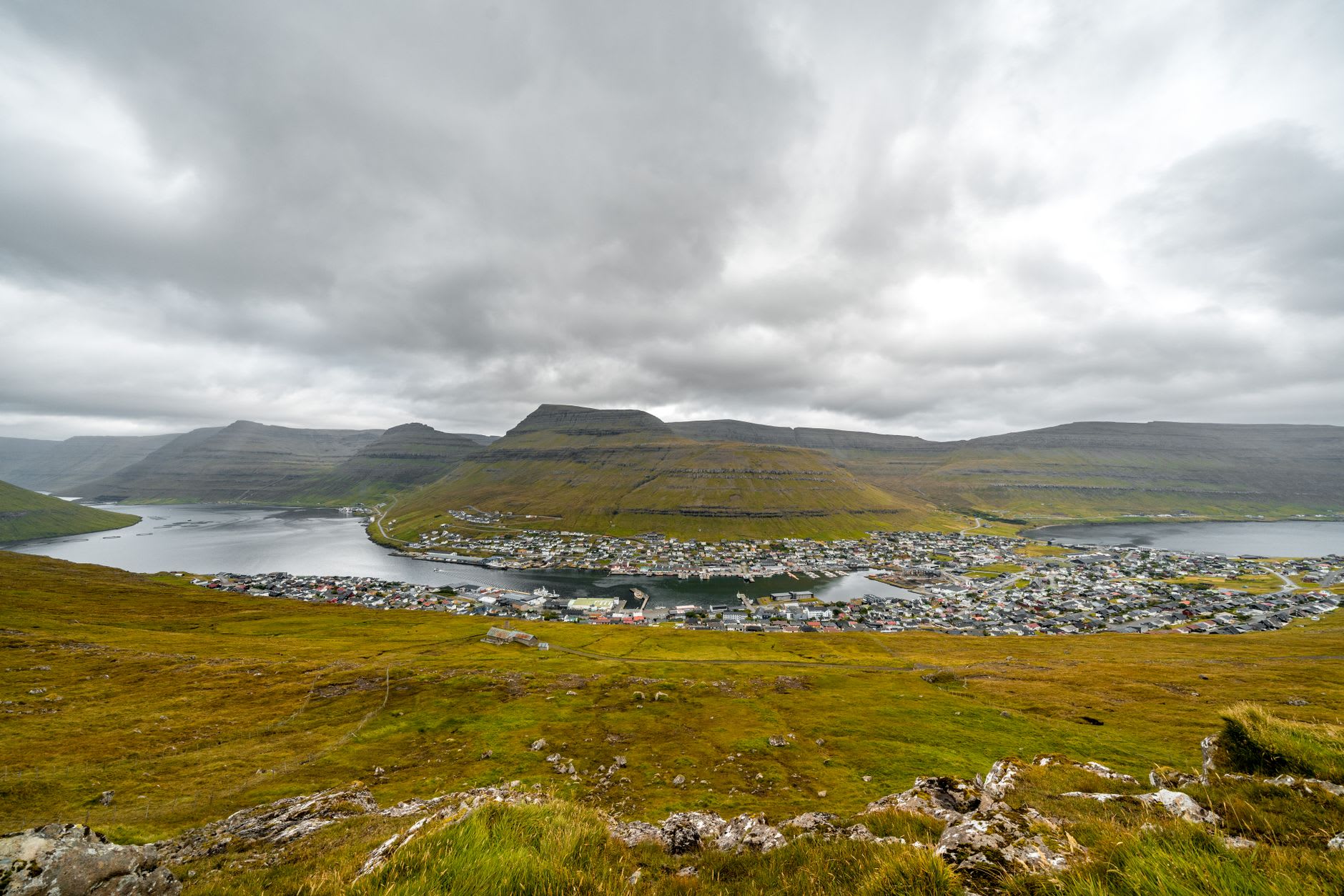
Sørvágsvatn — also called Leitisvatn, because Faroese place names operate on a democratic principle where a single place can carry two equally valid names — is the largest lake in the Faroe Islands. It sits on Vágar, the same island as the airport, reached by a walk from Miðvágur that takes roughly forty-five minutes each way. The path crosses moorland grass and passes a lower cliff before climbing to the ridge. The morning I went, cloud was low and mist moved in from the west in horizontal sheets. The lake appeared in sections — first the near shore, then the far cliff, then finally the full view opening in a gap between cloud walls: water stretching to a drop that, from where I stood, seemed to fall directly into the Atlantic without ceremony or transition.
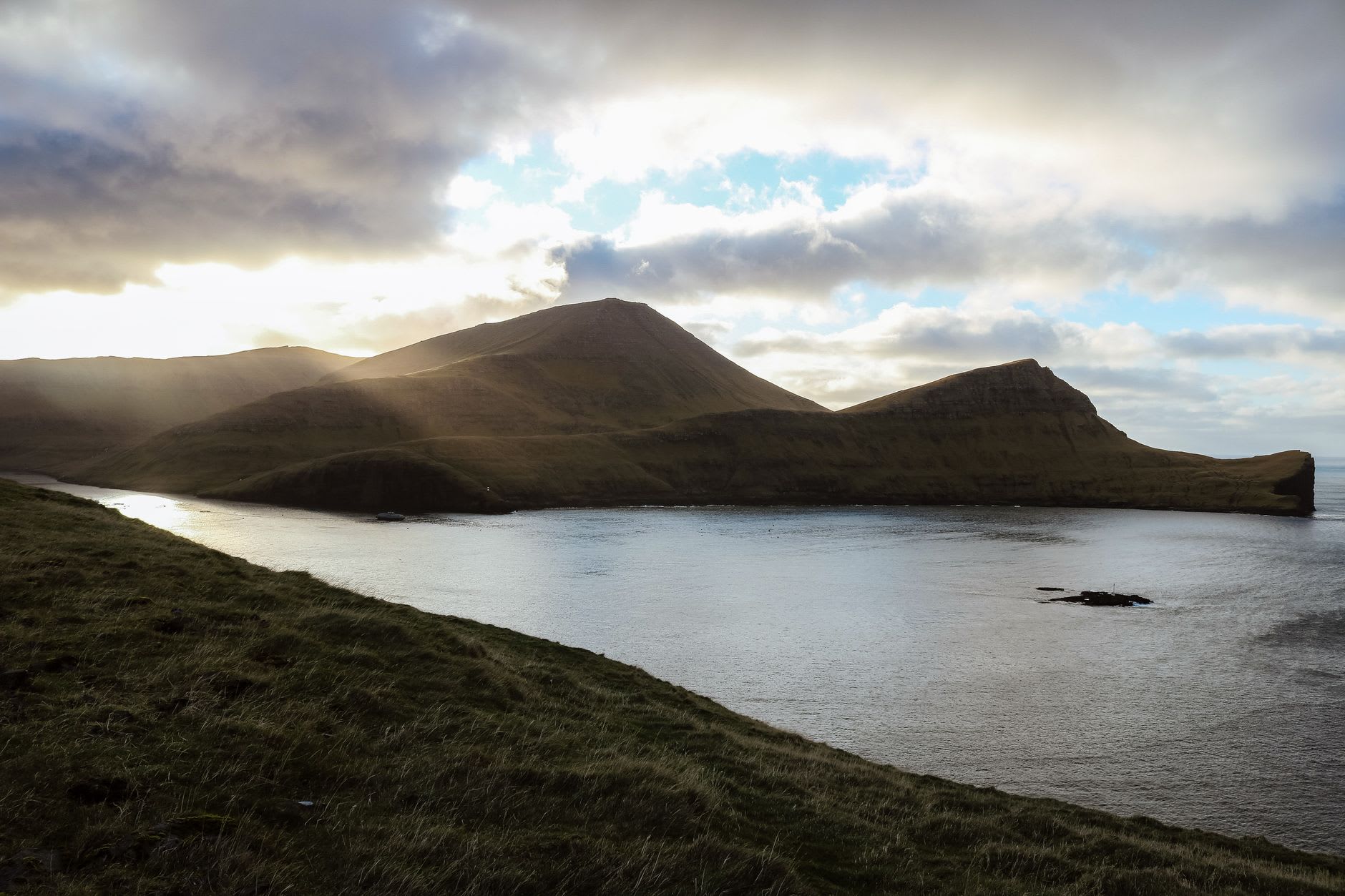
The cliff at the lake’s western end is called Trælanípa — Slave Cliff in Faroese, a name that comes from old accounts of thralls pushed from its edge during the Norse settlement period. It drops sharply to a ledge above the sea. Standing there, looking west into a sky and ocean that merge in grey at their boundary, I felt the particular vertigo that comes not from height alone but from the total absence of anything between you and the horizon — no boat, no island, no suggestion that the planet has a far side. The wind was strong enough that I kept one hand in the grass. The lake behind me reflected whatever the sky was doing, which that morning was shifting between two kinds of grey in a way that managed to be beautiful without being easy about it.
The walk itself is the thing I remember most precisely — not just the view at the end, but the moorland quality of the path, the way the sound of the ocean preceded the sight of it by a long time, the grass underfoot that was wet enough to soak through my boots by the time I reached the ridge. The Faroes are full of moments where the landscape does something you did not know landscape was capable of, and Sørvágsvatn is the most concentrated version of that claim. It earns its reputation by being, in person, somehow more extreme than the famous image.
When to go: The floating-lake effect reads most clearly on days with visible horizon definition — clear or partly cloudy is ideal. Late May through September gives the best light and trail conditions, with June and July offering the longest days. Walk in the morning for the low-angle light over the water. The cliff edge at Trælanípa requires dry conditions underfoot; it is not a place to test the edge in rain.