Great Sand Dunes
"The dunes make no geographical sense, which is precisely why standing in front of them feels like standing inside a dream you haven't had yet."
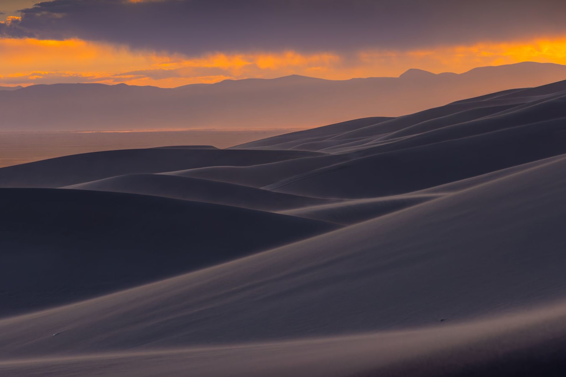
I had driven south from Salida through the San Luis Valley — the largest alpine valley in the world, a flat agricultural plain at eight thousand feet ringed by mountains — for an hour before the dunes appeared on the eastern edge of the valley. At first they looked like a smudge on the horizon, a thickening at the base of the Sangre de Cristo range, something unclear. Then the road curved and they came into proportion: massive star dunes, seven hundred feet tall, tan and rust and ochre, piled against the mountains as if the desert had decided to climb. The Sangre de Cristo peaks behind them still held snow in their upper folds. The juxtaposition is so improbable that my first instinct was to look for a logical explanation, as if the dunes might be some kind of elaborate natural illusion. They are not. They are simply real.
The dunes form from sand carried by the winds of the San Luis Valley, deposited over hundreds of thousands of years where the valley meets the mountains. Three creeks — Medano, Sand, and Mosca — carry the sand back down and the process repeats. The result is a dune field that has been in rough equilibrium for perhaps 440,000 years. Medano Creek runs along the eastern base of the dunes, seasonal and ephemeral, and in late spring it runs deep enough for children to play in and for adults to sit in shallow, the cold snowmelt current pushing against your legs while the sand above bakes in the afternoon heat. I arrived in late May and found families in the creek with the relaxed pleasure of people at a beach, the dunes rising immediately behind them, the mountains behind that.
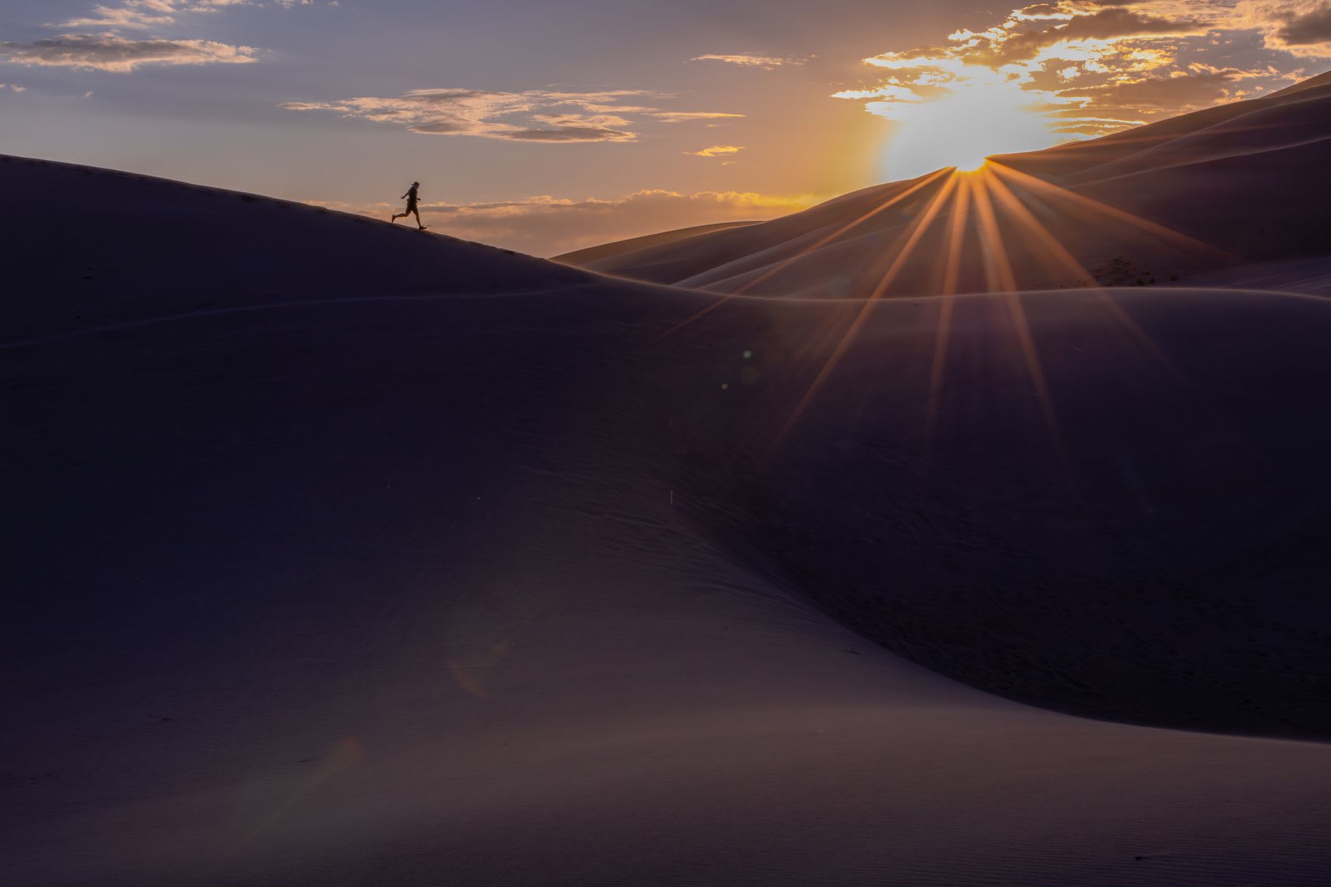
Climbing the dunes is hard work and worth it. The sand gives underfoot with every step, and the angle of the faces is steeper than they appear from below. I climbed High Dune — seven hundred and fifty feet from the floor — in about an hour, stopping twice, breathing harder than the exertion should demand because I kept forgetting to account for the altitude on top of the climbing. From the crest the view is its own category of strange: the flat valley floor on one side stretching to the San Juan Mountains sixty miles away, the sheer wall of the Sangre de Cristos on the other side, and below me the pure sand architecture of the dune field — ridges and bowls and shadowed faces, the wind drawing lines across the surface in patterns that change hourly.
The light in the late afternoon turns everything amber and then deep gold. The shadows on the dunes grow long and the ridgelines become sharp, architectural. I sat near the top of High Dune as the sun moved toward the western mountains and watched the colors change on the sand with the kind of attention I usually reserve for very good art. The dunes don’t apologise for the excess of their beauty. They are simply what they are, at whatever scale they are, with the mountains behind them, and the light doing its work.

Camping inside the park puts you in proximity to the dunes at night, when the wind picks up and the sand makes a sound like the edge of a living thing, and the stars at this altitude and in this valley — far from any city light — are as dense as I’ve seen anywhere outside of the Atacama.
When to go: May and June for Medano Creek at its highest flow — the creek runs from late April into July depending on snowpack. September and October for the best light and hiking temperatures, and to avoid the intense summer afternoon heat on the sand. Avoid July and August midday — the sand surface can reach 60°C.