Çatalhöyük
"Nine thousand years ago, someone painted a bull on a wall here, and I stood in front of it and felt completely young."
The site is fifty kilometres southeast of Konya on a road that crosses flat agricultural land so featureless that when the mounds appear — two humps in a wheat field, barely higher than the surrounding terrain — they register as almost absurdly modest. Then you read the sign: this is one of the largest and best-preserved Neolithic settlements in the world. People lived here continuously for roughly two thousand years, from approximately 7500 to 5700 BCE. I walked around the mounds before going into the visitor centre, trying to get a feel for the scale of the place from outside, and I could not quite make my mind accept it. Nine thousand years. The number sits in the brain and refuses to resolve into image.
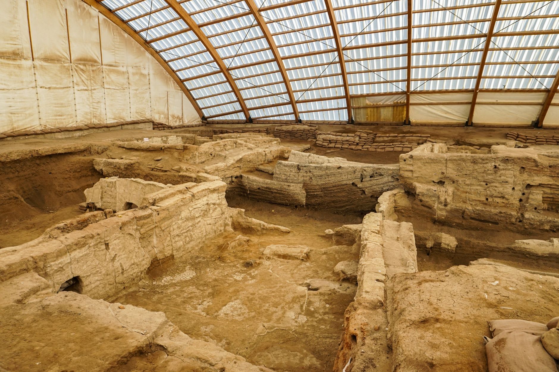
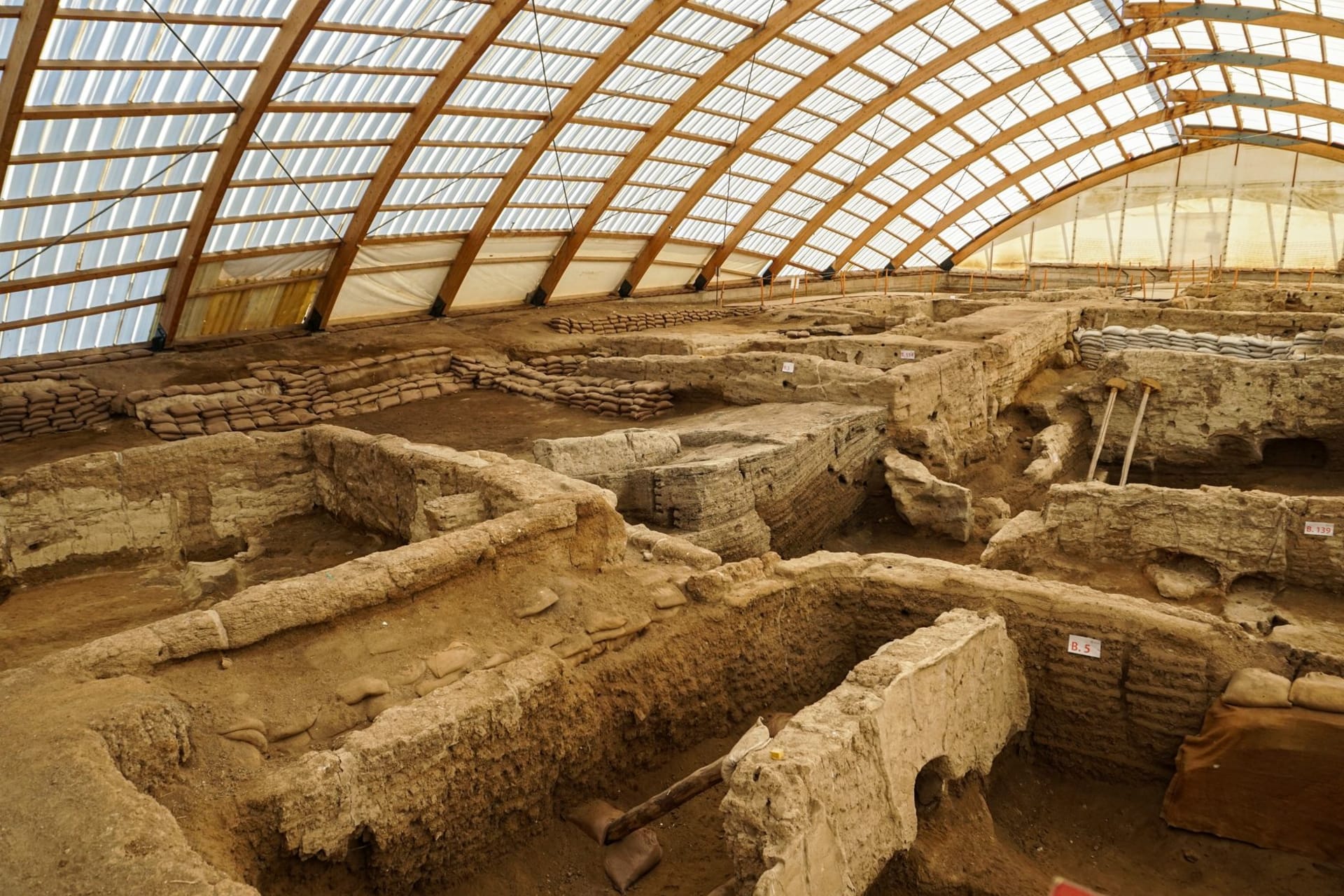
The visitor centre is small but thoughtful, with replica rooms reconstructed to the scale and proportions of the originals — and the proportions are part of the revelation. The rooms are very small. Roughly four by four metres. The inhabitants entered through a hole in the roof and descended by ladder, which means there were no doors, no ground-level entrances, no streets as we understand them. The city was a connected mass of mud-brick rooms, lived on top of like a platform, and when a room fell into disuse it was often buried and built over, which is why the mounds exist — the settlement rose by building on its own dead. The dead, in fact, were buried beneath the floor of the house where they lived. The archaeologists have found bodies under hearths, under sleeping platforms. The boundary between dwelling and burial was architectural rather than emotional.
The painted walls are reproductions in the visitor centre, but they are based on origorous documentation of the originals — and the images, executed in red ochre and black, are genuinely arresting. Hunting scenes with aurochs. Geometric patterns. Vultures descending on headless human figures. A map of the settlement itself, possibly the world’s oldest urban map. I stood in front of a replica of the aurochs painting for longer than I needed to, thinking about the person who painted it and finding the gap between them and me — the actual distance of nine thousand years — becoming paradoxically smaller rather than larger.
The dig is ongoing and has been since 1958, with serious excavation resuming under Ian Hodder’s team from 1993. You can sometimes see archaeologists working in the protected shelters over the dig areas, carefully uncovering floors that have been sealed for ninety centuries. There is something in this image — the person with a fine brush on their knees, the steppe stretching away behind them — that makes the whole human project feel admirably stubborn. Someone laid this floor. Someone is uncovering it. And in between those two acts: everything.
When to go: April through October; the site is open year-round but winter access to the outdoor areas can be muddy. Combine with a Konya visit — it’s a straightforward day trip. Go early; by midday the shelter canopies trap heat and the site can feel airless.