Ha Giang
"The Ha Giang loop teaches you that the best road in Vietnam is the one most travellers still haven't found."
Vietnam's most dramatic motorbike loop, threading through rocky plateaus and ethnic minority villages.
There is a moment on the Ma Pi Leng Pass — somewhere between the third switchback and the first real view of the Nho Que River threading turquoise a thousand meters below — when you stop thinking in words. The road is barely wide enough for two bikes to pass without a negotiation, and the cliff drops so cleanly that it looks less like erosion than intention. I sat there for a long time. Lia had pulled over a hundred meters ahead and was just standing at the railing, not taking photos, not saying anything.
That silence was the beginning of Ha Giang.
The Road Nobody Warned Me About
Ha Giang province sits at Vietnam’s northern extreme, pressed against the Chinese border and largely ignored by the banana-pancake trail that moves between Hanoi, Hoi An, and Ho Chi Minh like a conveyor belt. To get here you either take an overnight bus from My Dinh station or rent a semi-automatic — locally called a xe so — and accept that the road will challenge you constantly and reward you without apology.
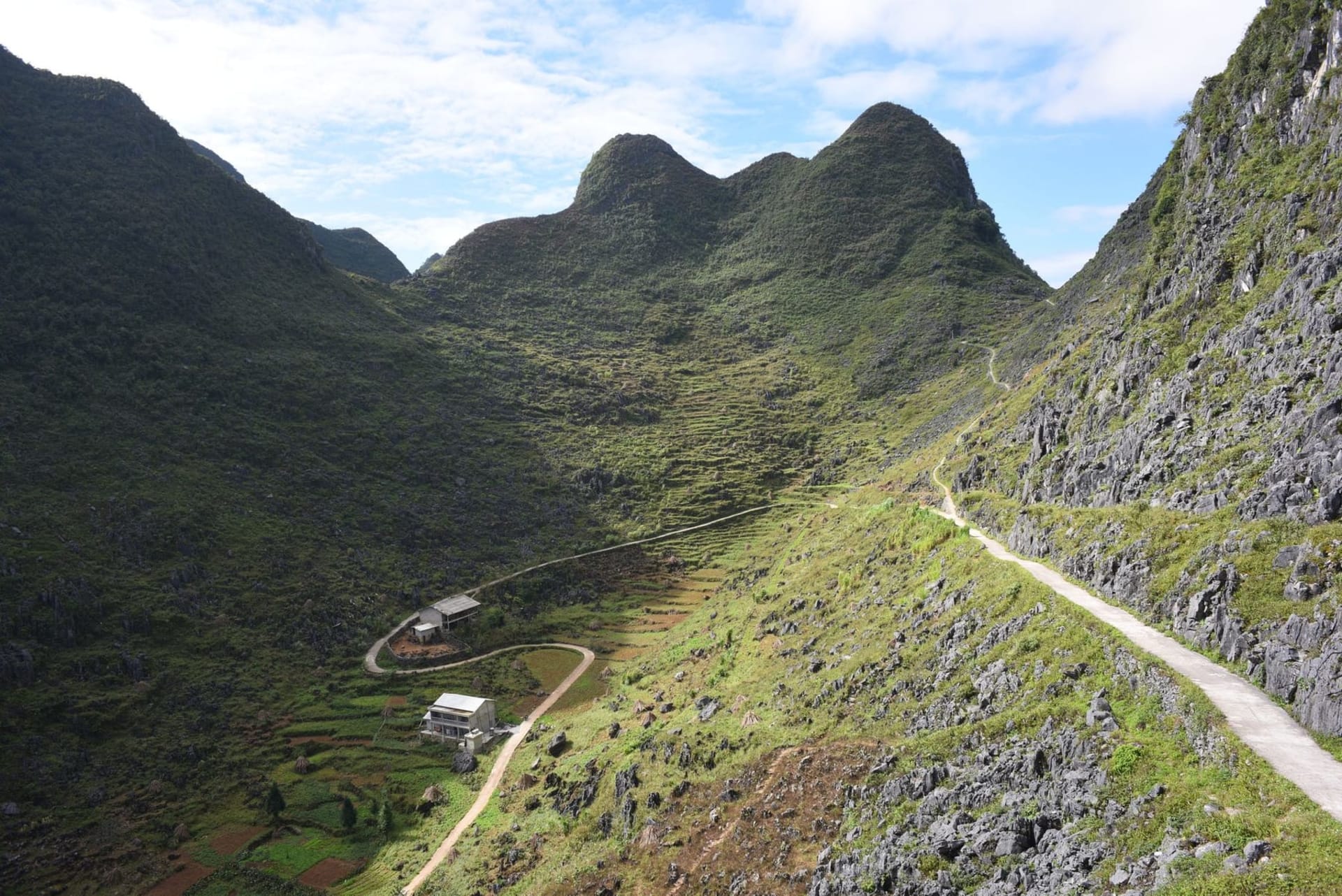
The loop itself — roughly 350 kilometres depending on which detours you take — passes through Dong Van, Meo Vac, and a dozen smaller Hmong and Lo Lo villages where the Sunday market at Lung Phin still smells of woodsmoke, raw indigo, and the particular sweetness of freshly distilled corn liquor. I bought a small bottle from a woman at the Dong Van market who had no interest in bargaining and even less interest in tourism. She poured it into a recycled water bottle, tied it with string, and handed it over with the transaction completely settled.
What the Plateau Actually Feels Like
The Dong Van Karst Plateau is UNESCO-listed, which tells you everything about the geology and nothing about the texture of riding across it in October light. The limestone formations rise in fins and towers, grey and cream and occasionally rust-coloured where iron bleeds through. The air at this altitude — above 1,500 metres in places — carries a cold edge even in autumn, and the mornings smell of mist and turned earth.
The unexpected discovery: the rock walls. Every field is bordered by stone walls built without mortar by Hmong farmers over generations, stacking the karst fragments that make the land otherwise unworkable. From above, these walls create a geometry — grey lines across grey fields — that is completely unlike anything else in Vietnam.
We ate bun bo Hmong at a roadside place in Meo Vac where the broth had been going since before we arrived and would keep going long after — dark, fatty, with a chili oil that built slowly and stayed.
When to go: October and November offer the best combination of dry roads, cooler temperatures, and flowering buckwheat that turns the plateau pink. Avoid June through August when the mountain roads flood and visibility drops to almost nothing.