Kebnekaise
"You don't summit Kebnekaise for the view. You summit it to know you can."
Getting There Is the Point
The mountain station — Kebnekaise Fjällstation — sits twelve kilometers from the nearest road, which means every visit begins with a two-hour walk along the Ladtjovagge valley. The trail follows the Ladtjojakka river, which runs glacial-green in summer and freezes over in a complicated sequence of ice formations in winter. The valley walls rise steeply on both sides. On my first visit, a pair of golden eagles was working the thermals above the eastern ridge. I watched them for ten minutes and missed a section of trail I had to backtrack.
The mountain station itself is a full operation: beds, meals, guiding services, equipment rental. It’s the hub for everyone attempting the summit and also for people who just want to be in the valley for a few days. The clientele is a mix of experienced alpinists, Swedish families doing their first real wilderness trip, and solo walkers who spend dinner talking about the trails they’ve done elsewhere. The food is better than it needs to be.
The Southern and Northern Peaks
Kebnekaise has two summits. The southern peak, at 2,096 meters, is the higher one — though its exact elevation changes annually because it’s a rock peak capped with glacier ice, and that ice is receding. It is now measurably lower than it was twenty years ago. The northern peak, at 2,072 meters, is all rock and more technically demanding.
The standard summer route to the southern peak takes six to eight hours round trip from the mountain station. The first half is a hiking trail; the upper portion requires crampons and crossing the Björling glacier. Guides are mandatory for the glacier section if you haven’t done glacier travel before. I went with a guide group and was glad I did — the crevasse fields are not dramatic, but they are real, and the route across the ice is not intuitive.
The summit view, on a clear day, shows you the Norwegian coast. On a less clear day, it shows you fog and the satisfaction of having been somewhere difficult.
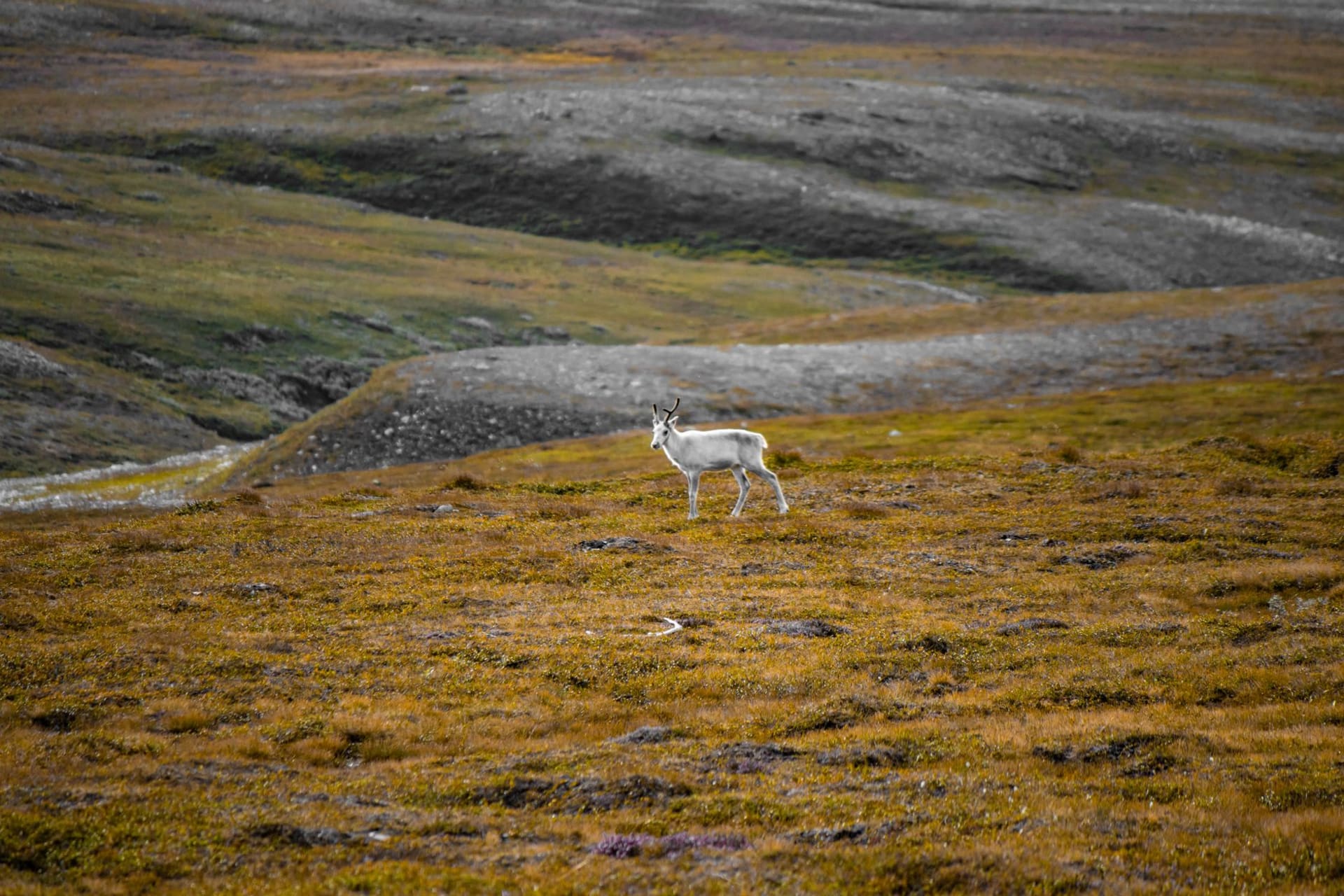
The Valley in Summer
People come to the mountain station without any intention of summiting, which I understand completely. The Ladtjovagge valley in July is a specific kind of beautiful: low shrubs in multiple greens, the river loud and brown with glacial sediment, reindeer moving through the vegetation in loose groups. The midnight sun means you can hike at ten in the evening in full daylight, which creates a dreamy inversion of the normal hiking day.
There are day hikes from the station that don’t involve glaciers: up to the Kitteldalen lake, along the river to the waterfall on the northern side. I walked to the lake one morning — the willowherb was in flower, pink and dense along the river, and the mosquitoes were catastrophic. Bring repellent and make peace with it.
Winter at Kebnekaise
In winter, the mountain station operates as a ski touring base. The valley becomes a silence so complete it has texture. The northern lights appear above the peaks. The summit routes require serious alpine experience in winter. Most winter visitors come for the cross-country skiing and the stillness.
When to go: Late June through September for summer hiking and the summit routes — July offers the best conditions on the glacier. March for ski touring and northern lights, though the summit requires more technical preparation in winter. The mountain station is generally open February through October; check their website for exact dates.