Cape Guardafui
"Standing there, I understood why ancient mariners gave capes their own names."
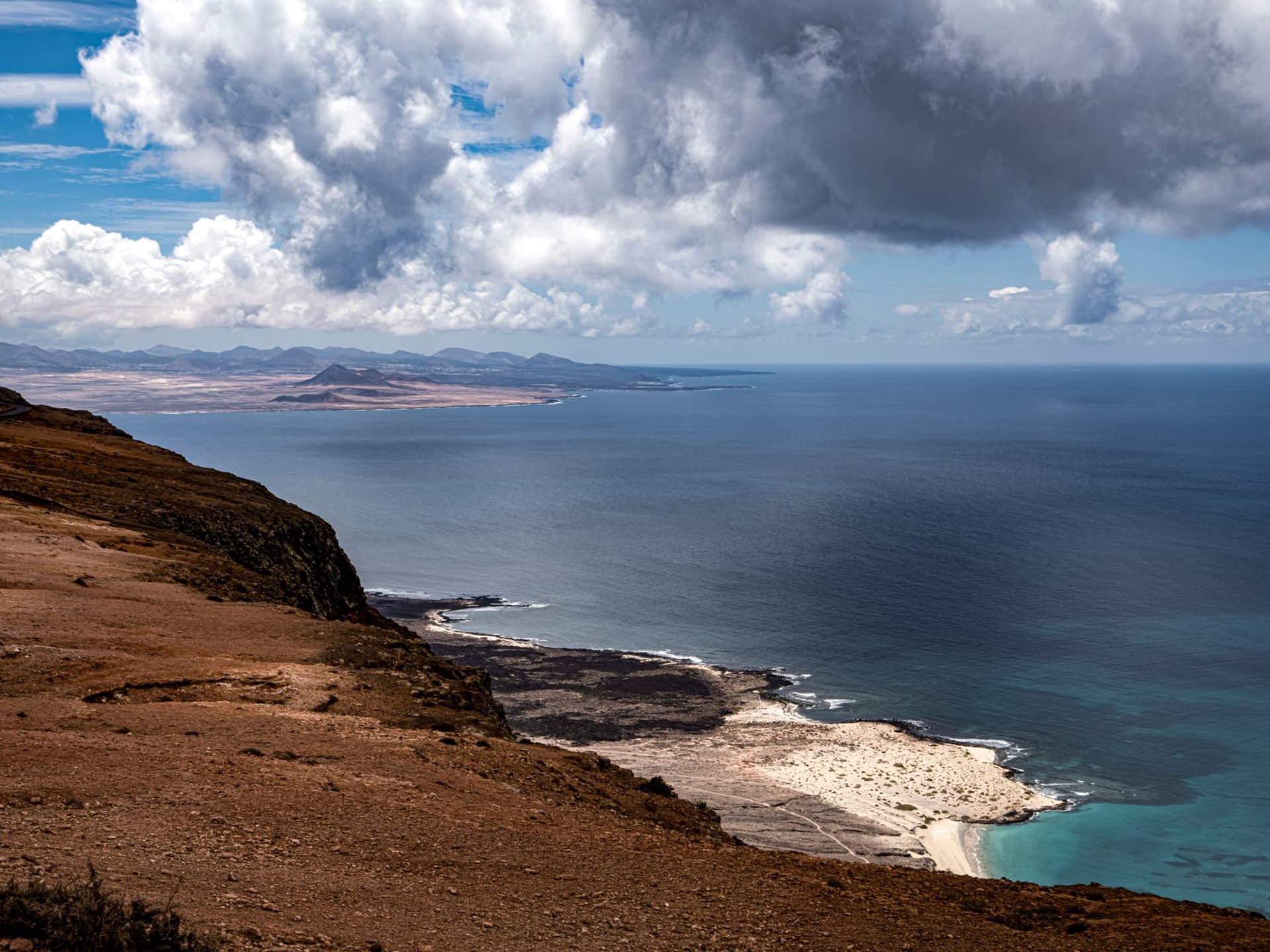
Cape Guardafui is not easy to reach, which is part of why it matters. The northeastern tip of the Horn of Africa — the cape that ancient Greek and Arab sailors called Aromata, the Cape of Spices, for the frankincense that wafted offshore from the highland forests — juts into the sea at the exact point where the Gulf of Aden becomes the Indian Ocean. Standing there, you are at the 51st meridian east and the 11th parallel north, and you are looking at two seas behaving differently on either side of you, separated by a limestone ridge.
The Meeting of Two Seas
The physical phenomenon at Cape Guardafui is the collision of the Gulf of Aden current running east with the Somali Current of the Indian Ocean running north. In certain light and sea conditions, you can see the line where the two bodies of water meet — different colors, different chop patterns, different temperatures. This is not a subtle thing, not a phenomenon you need to squint at. The line is visible.
The current makes the cape one of the most navigated and historically feared passages in the Indian Ocean world. Arab dhows running the trade route between East Africa and the Gulf had to round it carefully. The Periplus of the Erythraean Sea, written in the first century AD, describes the cape and the offshore islands with the respect of someone who had heard accounts of what happened to boats that misjudged it.
The Lighthouse and the Plateau
An Italian-built lighthouse stands on the highest point of the cape, constructed in the colonial period when reliable light at this navigation hazard had been a maritime priority for decades. The lighthouse still functions. The building around it is in the standard condition of isolated infrastructure maintained through determination rather than resources — functional but worn, painted over more times than the paint can hold, battered by constant wind.
The plateau at the tip of the cape is open, dry, and spectacularly ventilated. The wind rarely stops. The vegetation is low and xerophytic — wind-shaped, salt-adapted, surviving on what the sea moisture provides. The views in every direction are unimpeded: Gulf of Aden to the north, Indian Ocean to the east, the rocky coastline of the Guardafui Channel curving south and west.
Getting to the End of Africa
Reaching Cape Guardafui requires genuine commitment. The nearest significant town is Bosaso, roughly 300 kilometers to the northwest by rough coastal track. Overland routes are slow and require a capable 4WD and local guidance. Boats from Bosaso or the Puntland coast offer an alternative approach when sea conditions allow. Small charter flights reach the area with advance planning.
The effort filters the visitor pool entirely. I met no other travelers on my visit — only the lighthouse keeper and two workers maintaining the generator, men who had been in this isolated posting for months and had developed an equanimity about it that I found slightly awe-inspiring.
What the Isolation Offers
There is a specific mental state that remote geography produces, and Cape Guardafui produces it in concentrated form. The noise — phone, news cycle, social friction, the background hum of being connected — all of it drops away inside an hour of arriving, and what replaces it is an attentiveness to what is actually in front of you: the sound of the sea on two sides, the light changing on the water, the lighthouse beam at dusk, the extraordinary, impersonal fact of being at the tip of a continent.
When to go: October through March, when seas are calmer and the northeast monsoon makes the cape more approachable by boat. The southwest monsoon (June–September) brings dangerous sea conditions at the cape itself. This is always a journey requiring current local knowledge and reliable logistics.