
Bản Giốc Waterfall
"The border runs through the middle of the waterfall and the water doesn't know or care."
There is something philosophically satisfying about a waterfall that doesn’t respect international boundaries. Bản Giốc — Detian Falls on the Chinese side, which sounds less poetic — straddles the border between Vietnam and Guangxi province of China, and the distinction means exactly nothing to the Quây Sơn River that drops over its tiered limestone edge in a curtain of white that, at peak flow, is over three hundred metres wide. I arrived in September, after heavy rains, and the falls were running hard enough that I felt the mist fifty metres back, a cold spray that immediately fogged the lens of everything I’d brought to photograph with.
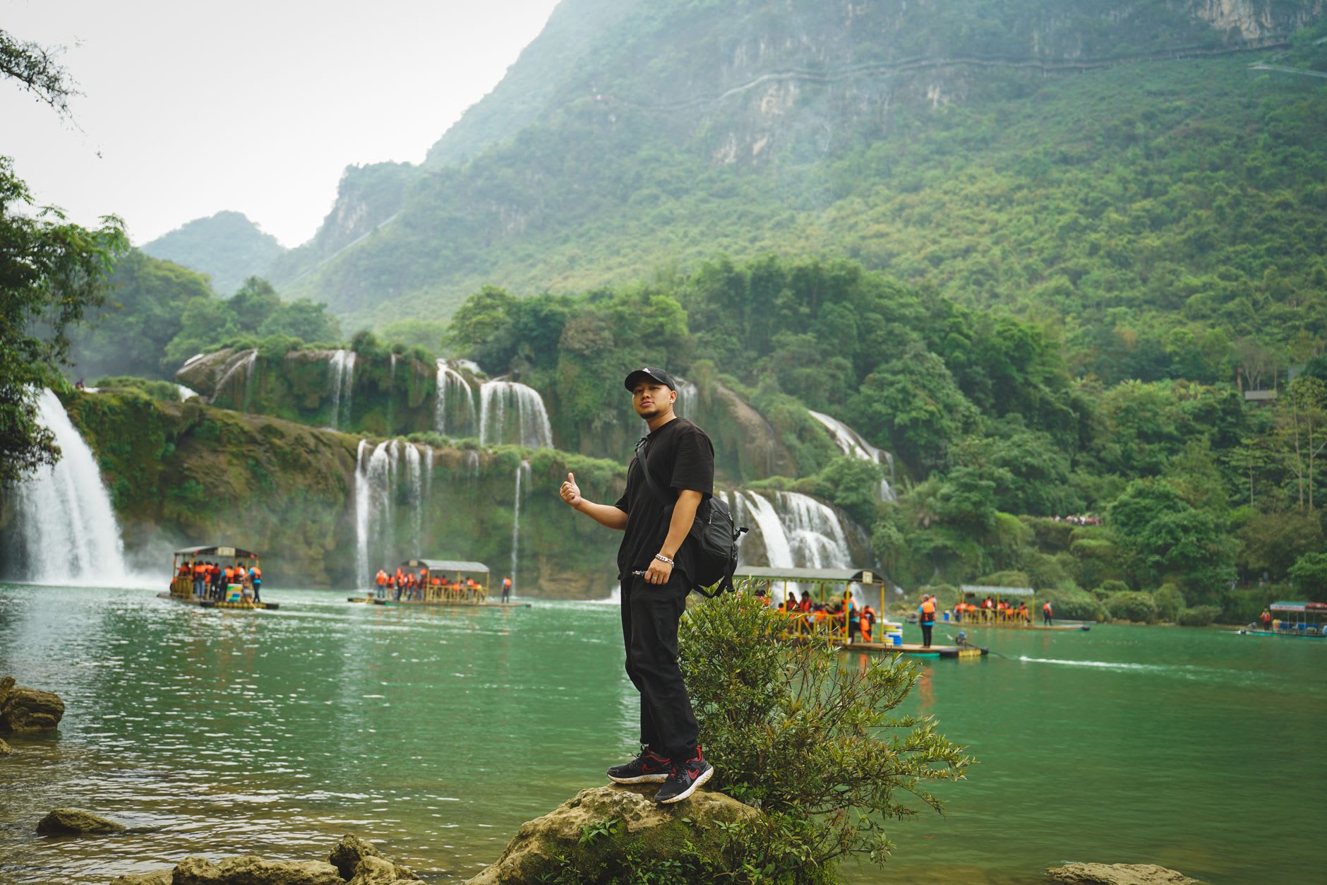
The approach is managed now — parking area, ticket booth, a walkway with viewing platforms at measured intervals — but the falls themselves defeat any attempt to domesticate their surroundings. The sound is foundational, the kind of low roar that doesn’t so much register as noise as it does rearrange the quality of the air. The bamboo rafts that depart from the Vietnamese bank can take you across the pool toward the falls’ base, close enough that coherent thought becomes briefly difficult and you simply sit in the noise and the spray and give up trying to photograph anything and look instead.
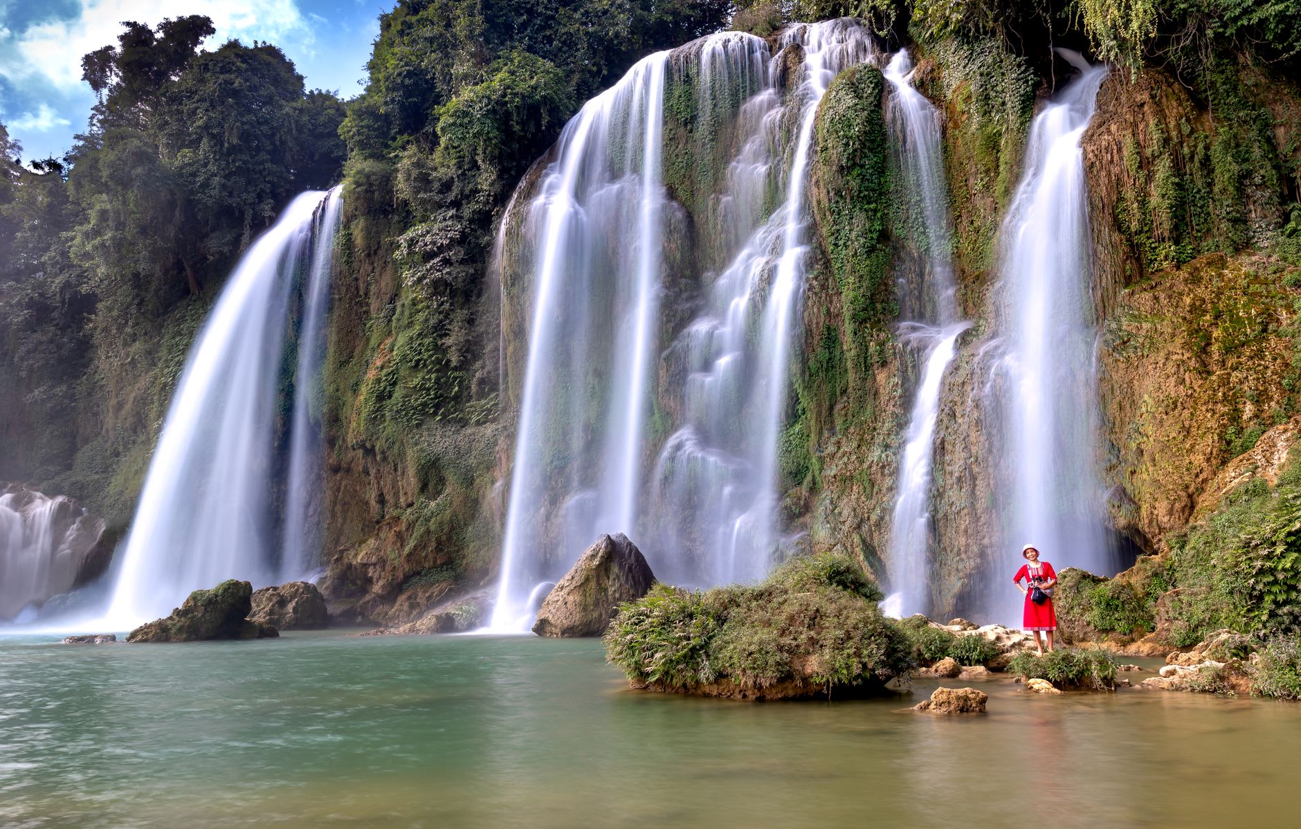
The pool at the base is a blue-green that photographers struggle to render accurately — the colour is real, produced by the limestone geology of the riverbed, and on clear days it reads almost luminescent against the white of the falls and the dark forest behind. The Chinese side is visible across the water, and on Chinese tour group days you can hear the tour guides’ amplified commentary faintly through the roar of the falls, which is an oddly companionable intrusion. Both sides of the border get the same waterfall. The raft trip on the Vietnamese side is worth the small fee; the view from the Chinese bank, had I crossed, would have been the same falls from a different angle.
The surrounding landscape of Trùng Khánh district is the part most visitors undervalue. The road north from Cao Bằng passes through an agricultural valley ringed by karst peaks where the fields are planted in maize and rice and the villages are Tày and Nùng communities that have been growing food in this landscape for longer than the modern border has existed. The roadside stalls sell corn roasted over charcoal, local honey in recycled water bottles, and fruit I’d never encountered — a small yellow plum that tastes of both sweetness and a high, almost astringent note that the local name, which I can’t reproduce from memory, presumably captures better than I can.
Ngườm Ngao Cave, about three kilometres from the falls, is a limestone cave system that extends for nearly three kilometres and is lit in a way that is, by cave-lighting standards, relatively restrained. The stalactite and stalagmite formations are genuinely impressive in scale — some of the chambers are large enough that the ceiling disappears into dark — and the cave stays cool year-round in a way that feels like compensation for the heat outside. Tour groups proceed through in forty-five minutes; arriving just after opening at seven-thirty gives you the first thirty metres of silence before anyone else comes in.
When to go: September and October bring the falls to their most powerful flow — full, dramatic, loud — and the rice harvest in the surrounding valleys turns the landscape golden. Dry season (November through April) reveals the limestone tiers more clearly and the pool is calmer for the raft trip, but the volume of water is considerably reduced. The falls are at their least impressive in March and April; they are never actually disappointing, but the difference between monsoon flow and dry season flow is substantial.