Jala
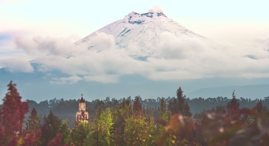
"The volcano sits right there behind the church, visible from every street corner, and the locals have clearly made their peace with it."
I arrived in Jala at midday, when the plaza was mostly empty except for a man selling elotes from a cart and two teenagers on the church steps who looked mildly puzzled to see a stranger arrive with a backpack. Behind the bell tower of the Templo de la Purísima Concepción, Ceboruco sat in full view — grey-green, vaguely menacing, exhaling nothing visible but carrying the memory of its last eruption like a credential. I kept waiting for the locals to acknowledge it. They do not. You either make your peace with the volcano or you move somewhere else, and most families here have been making that peace for generations.
Ceboruco and the Lava That Stayed
The trail up Ceboruco begins a few kilometers east of town, where the pine forest thickens and the road narrows to something that rewards a truck or demands a particular confidence in your sedan. I went in the early morning, when the temperature was still reasonable and the light came slanted through the pines. The path climbs through forest before breaking abruptly into open lava fields — black and jagged, hardened mid-flow in 1875 and left precisely as they fell. The effect is geological whiplash: the forest simply stops, and then there are several hundred meters of petrified chaos before the trees resume on the other side.
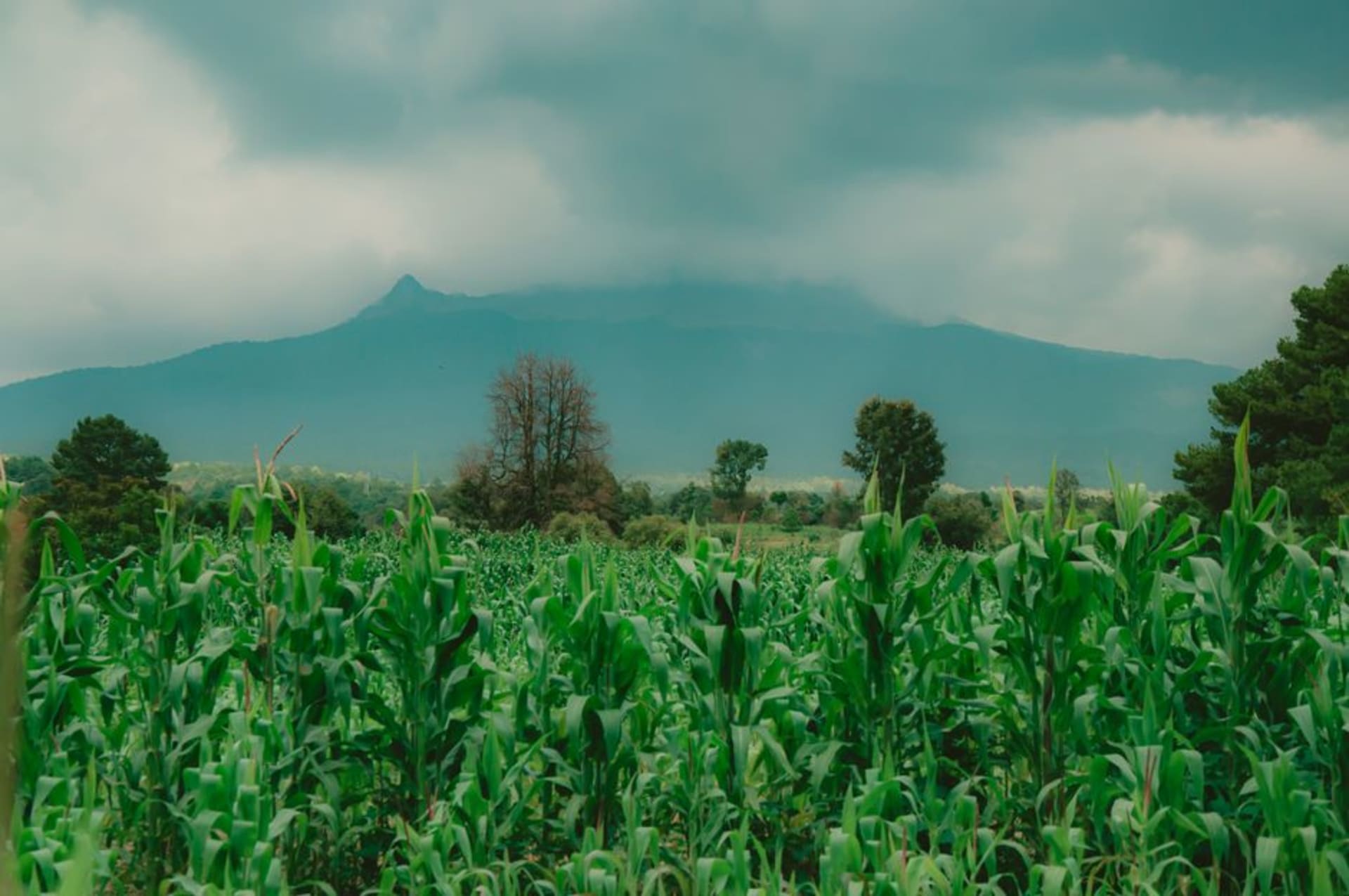
The crater rim is reachable on foot, and from it you catch the sulphur from the active vents — not alarming, more like a reminder that the thing underneath is not entirely finished. On clear mornings, the Pacific is visible to the west. Jala below looks like a child’s model: orange rooftops, a white bell tower, the green rows of the corn fields laid out in the flatland.
The Tallest Corn in Mexico
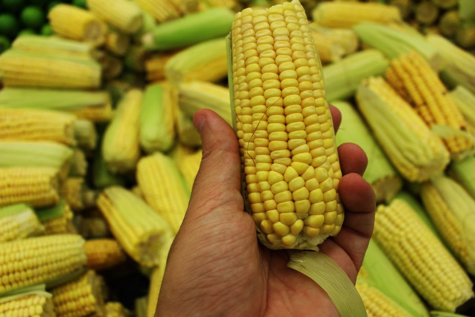
The maíz jaleño is a heritage cultivar so unusual that the Mexican government has listed it as a protected variety. It grows to four meters — overtaking most doorframes, most ceilings, and certainly most people — and during the Festival del Maíz each August, the town brings in the biggest stalks, measures them competitively, and crowns a queen. It is the kind of ritual that only develops somewhere corn has been load-bearing to daily life for centuries.
Outside of festival season, I found elotes and esquites on the plaza in the late afternoon, prepared in the Nayarit fashion: lime-forward, chile-forward, served in a styrofoam cup that somewhat undercuts the heritage-cultivar romance but tastes excellent anyway. The tortillas at the comedor on Calle Hidalgo were thicker than what I am used to in Oaxaca and had a sweetness I did not expect — a product of the local variety, the woman behind the counter told me, the way you might explain something obvious to a foreigner.
The Plaza and the Pace
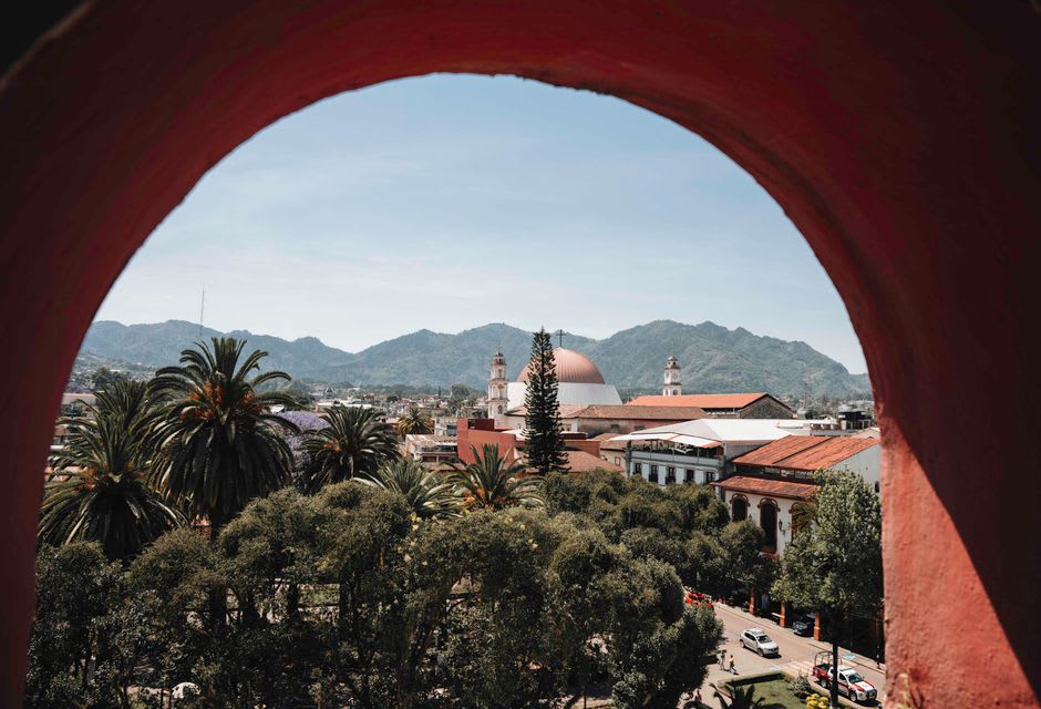
Jala’s centro is small enough to walk every street in an afternoon without trying. The facades run in ochre and terracotta, and the Templo de la Purísima Concepción anchors the main square with appropriate gravity. One block off the plaza, the municipal market has a comedor where I ate a bowl of caldo de pollo so deeply yellow it looked like it had been reducing since the Porfiriato.
I would suggest arriving with no agenda in particular. Sit in the plaza. Order something from the señora with the handwritten sign. The pace here is not slow in the way that frustrates — it is slow in the way that reminds you a town does not need to perform for visitors to be worth visiting.
Getting There
Jala sits roughly 90 kilometers north of Guadalajara along the Guadalajara-Tepic highway — an easy two-hour drive. There is no direct long-distance bus into town; the nearest transfer point is Ixtlán del Río, 12 kilometers north, where colectivos cover the last stretch. The dry season, November through April, is best for the Ceboruco hike. Come in August for the corn festival if you want the town at its most itself.