Ciudad Hidalgo
"Driving Mil Cumbres on a clear morning with pine forests on both sides and a thermos of coffee — I will make a case for this being the best stretch of road in Mexico."
I drove into Ciudad Hidalgo on a Tuesday morning in November, arriving from Morelia on the older federal road rather than the toll bypass that most drivers take. This was, in retrospect, the correct mistake. The town appeared gradually — pine-shaded outskirts, a church tower, the smell of wood smoke — and what I had planned as a fuel-and-coffee stop became something closer to an afternoon. Ciudad Hidalgo sits at around 1,800 meters, at the eastern foot of the Mil Cumbres range, and it has the particular calm of a city that the main highway has mostly forgotten.
The Road That Earns Its Name
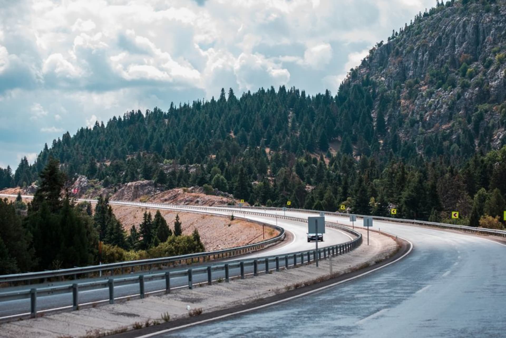
The Mil Cumbres stretch of Federal Highway 15 begins properly a few kilometers west of town, and I will tell you plainly: I have driven a lot of Mexican roads, and this one is different. The pine forests don’t just appear beside the road — they close over it, creating a corridor of green that filters the light into something soft and almost alpine. The temperature dropped from 22 degrees at the town’s gas station to something in the low teens by the first high pass, within fifteen minutes. I had a thermos of café de olla from a stall near the mercado, and I made a note in the car that this specific combination — Mil Cumbres at nine in the morning, clear sky, pine resin in the cold air, sweet coffee — constitutes a serious argument for the route being the best stretch of road in the country. The mirador partway up offers a view across successive ridgelines disappearing into a haze that could be clouds or distance or both; I stopped there longer than I meant to.
The Square Has Good Timing
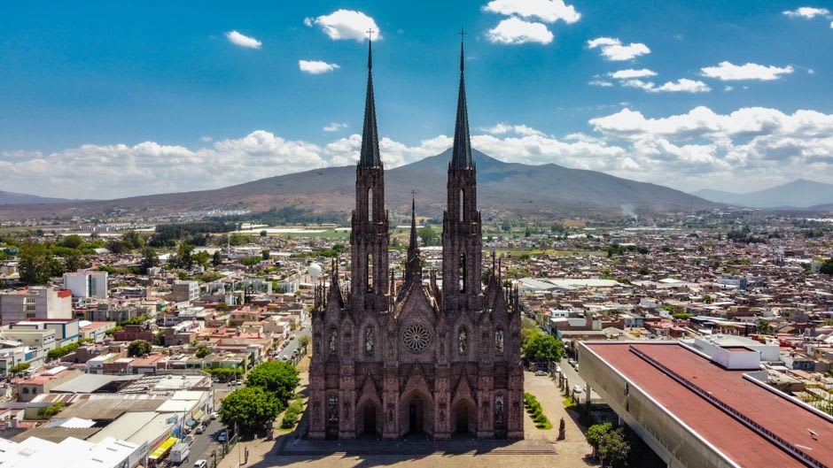
The zócalo in Ciudad Hidalgo follows the colonial template — parish church on one end, portales on the sides — but there is a quietness to it that I associate with cities that organized tourism has mostly skipped. On weekday mornings the market on Calle Hidalgo sells gorditas stuffed with chicharrón prensado and requesón, and the coffee, when you find the right stall, arrives in a clay cup sweetened with piloncillo. The Parroquia de Santiago Apóstol across from the square is a sober, well-proportioned colonial church that doesn’t try to overwhelm you. Ciudad Hidalgo is also, quietly, a working agricultural town, producing avocados and other subtropical crops on the warmer lower slopes — the markets reflect this, and the produce is notably fresher than what you’d find at a larger distribution point. Afternoons on the square slow to a particular pace. A shoe-shiner, a few old men on the same bench, pigeons.
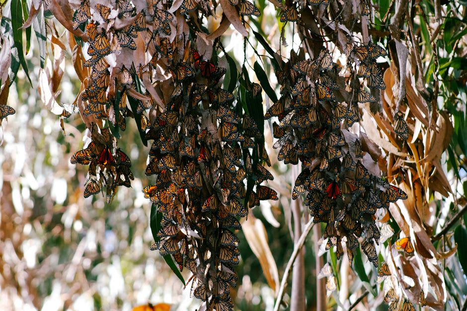
The Butterflies Are the Reason November Exists
Ciudad Hidalgo is one of the calmer access points to the Monarch Butterfly Biosphere Reserve, whose sanctuaries at Angangueo and El Rosario sit roughly 60 kilometers north via Highway 15 and then mountain roads. The migration peaks between November and early March, and if you time it correctly — mid-December, mid-morning when the sun warms the oyamel firs enough for the colonies to stir — the experience is disorienting in the best way: wings audible, trees that are also moving clouds, cold pine air. Ciudad Hidalgo makes a logical base for this; the town at Angangueo is smaller and closer if the butterflies are your only reason to be in the region, but Ciudad Hidalgo has better infrastructure and a better market.
Getting There
Ciudad Hidalgo sits on Federal Highway 15, roughly 100 kilometers east of Morelia and about 150 kilometers southwest of Toluca. Several bus lines connect it to both cities daily from their respective central terminals. By car, the toll road bypasses the most scenic portion of Mil Cumbres — take the libre if you have an extra hour and a full tank. Altitude is approximately 1,800 meters; pack a layer.