Bahía Concepción
"There is a moment on the Baja highway when you come around a bend and the bay opens up below you. I have come around that bend three times now. It still does what it does."
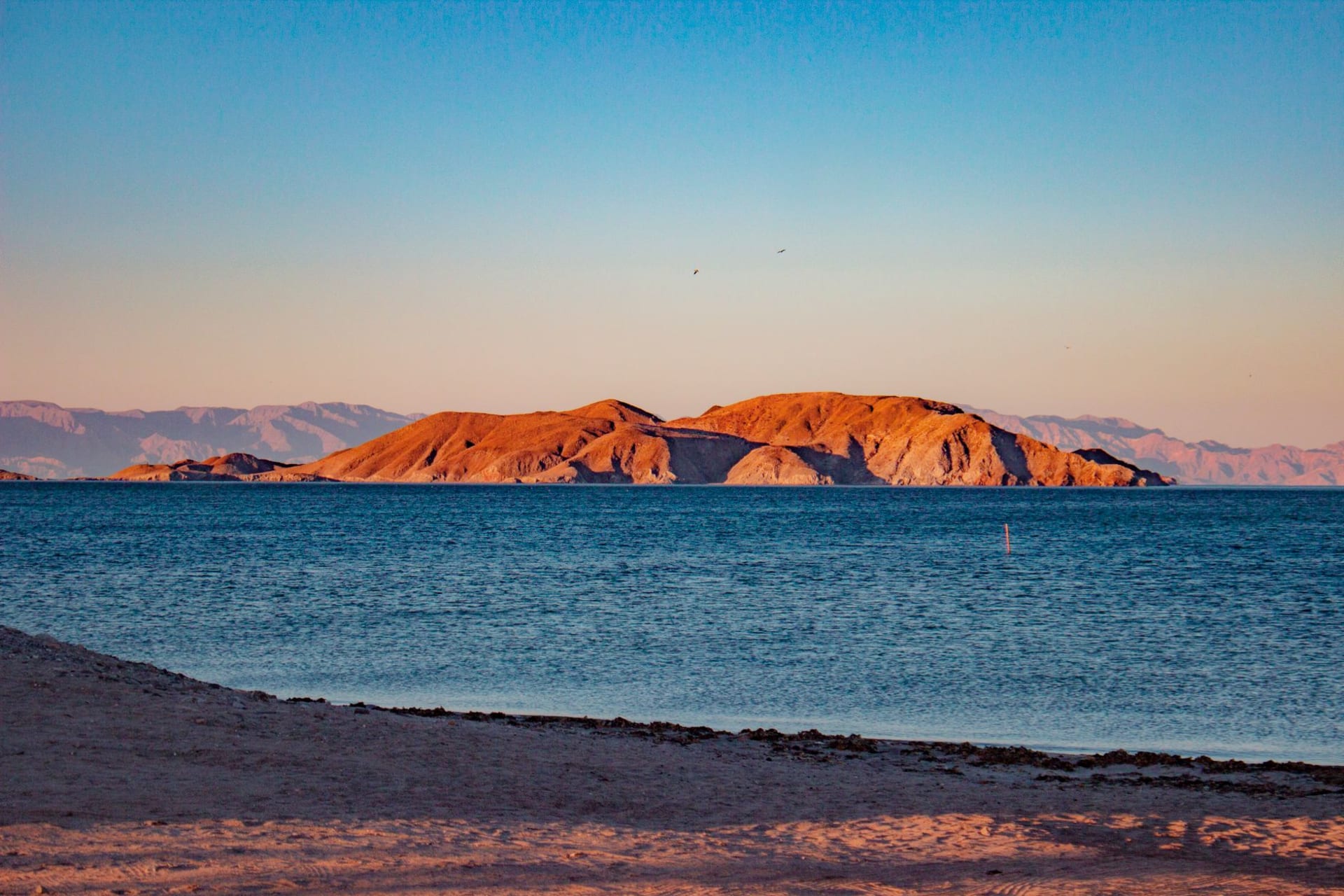
Highway 1 through Baja California is one of the great drives — long, empty, through desert and mountain and the periodic small city, with the Pacific on the west and the Sea of Cortez periodically appearing on the east. I had driven sections of it before without getting the full picture. Bahía Concepción is the part that converts people.
The highway approaches from the north after Mulegé, and there is a specific moment — a long bend around a hill — where the bay opens up below you for the first time. It is one of those views that is better than photographs suggest, partly because of the scale (the bay is about 50 kilometers long and very enclosed) and partly because of the color, which in the shallow water of the Cortez has a quality I find almost impossible to describe accurately: green and turquoise simultaneously, bright in the same wavelength as tropical water but cleaner, sharper, without the heaviness of the Caribbean.
The highway runs directly along the eastern shore. You don’t have to turn off to find beaches. They arrive one after another, each signed with a name and a small access road leading down through the desert scrub to the sand.
The Beaches, One After Another
I stopped at Playa Santispac first, which is the most visited and has the most infrastructure — permanent palapa structures for rent, a couple of small restaurants, a row of campervans from the United States and Canada that have been here since October and will leave in April. The campervan contingent is a fixture of Bahía Concepción in the winter months: retired Americans and Canadians who drive south in the autumn and settle at these beaches with the methodical ease of people who have done this many times and have made the equipment decisions necessary to do it comfortably.
I ate fish tacos at the restaurant on the beach. The fish was local, whatever was current from the pangas — I asked and was told something I didn’t catch, something from the lower Cortez. It arrived battered and fried with cabbage and a thin white crema and two limes and was exactly what I needed after three hours of driving.
The water was warm enough to swim in without the initial shock that cold-water swimming involves. I went in up to my waist, which is where I stayed because the shallow bottom extended far out and the gradual entry is less satisfying than the plunge option. The water was clear enough to see my feet on the sand five meters out.

Three Beaches, One Day
I drove further south to Playa El Coyote, which is smaller and less organized than Santispac — fewer permanent structures, no restaurant, the camping more genuinely informal. A family had a fire going in the late afternoon. A dog of unclear ownership investigated my car and lost interest. The beach here curves differently and you can see further down the bay to where it narrows and the hills on the west shore come closer.
I swam here properly, meaning I went in all the way and swam out until the bottom disappeared and floated on my back and looked at the blue Baja sky and listened to nothing in particular. There is a specific quality to swimming in the Sea of Cortez in January — the water temperature is warm enough to be comfortable but not so warm that it loses its refreshing effect, and the salt content makes floating easy. I stayed in the water for longer than I planned, which is a theme of this bay.
The third beach I stopped at briefly, only to look. By then the light was going horizontal and orange across the water, the desert hills on the far side of the bay going from tan to rose to something darker, and I stood at the water’s edge for ten minutes without doing anything else. This is also what the bay is for.
Why People Drive All of Baja for This
I have met several people who drove the length of the Baja Peninsula specifically to spend time at Bahía Concepción. This seemed, before I came here, like an extreme response to a beach destination. After one day at the bay I understood it completely.
What Bahía Concepción has that’s rare is the combination of protected, swimmable water with complete absence of resort infrastructure. There are no hotels. There are palapas for camping and a few basic restaurants. The highway is two lanes. The desert comes directly to the sand. In France, a bay this beautiful within two hours of a capital city would be fortified with concrete by now — there would be a resort, parking structures, jet ski rentals. Here it is still, somehow, just a bay.

Getting There
Bahía Concepción is on Highway 1 between Mulegé to the north and Loreto to the south. If you’re driving the Baja Peninsula, you pass directly through it — the beaches are accessible directly from the highway. The nearest towns with services are Mulegé (about 15 kilometers north) and San Ignacio further north; Loreto is about 90 kilometers south. Camping is informal and inexpensive at most beaches. Come between November and March for the best weather and the warmest reliable water temperatures.