Menengai Crater
"From the crater rim you can see three lakes and a geothermal plant and understand that the Rift Valley is not done with itself."
The name, in the Maasai language, means “place of corpses” — a reference to the battle fought here in 1854 between two Maasai clans, the defeated pushed into the caldera where they died. I learned this from a man selling roasted maize at the viewpoint on the crater rim, who delivered the historical note with the measured matter-of-factness that Kenyans often use for details that Europeans tend to over-dramatize. Then he handed me the maize and pointed out Lake Nakuru below.
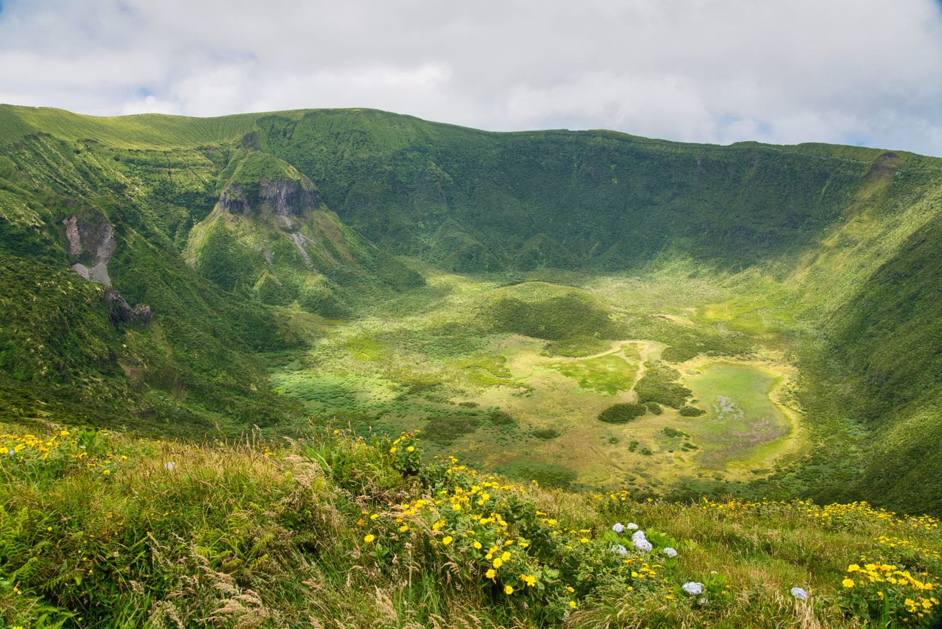
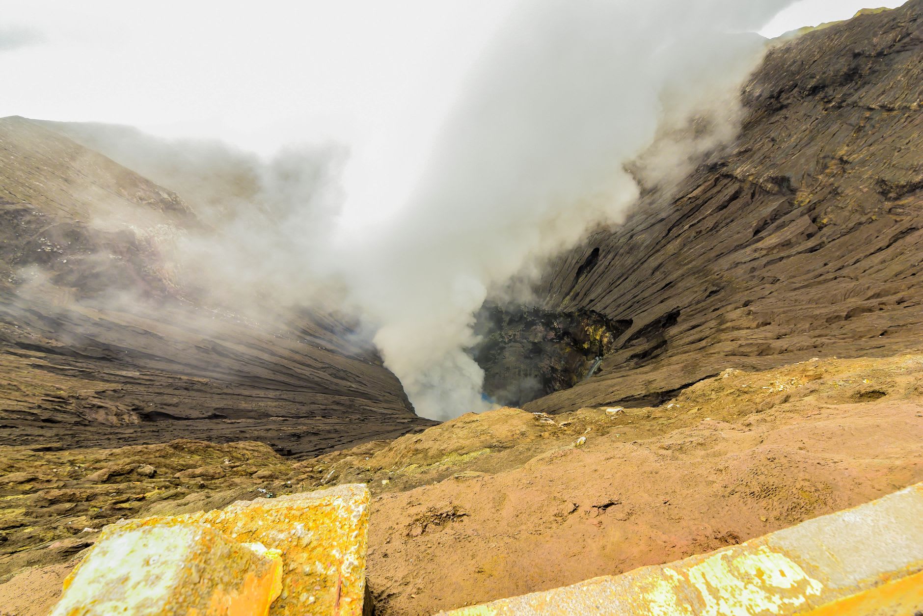
Menengai is one of the world’s largest calderas, roughly twelve kilometers across, formed when a volcanic system evacuated its magma chamber and the surface collapsed inward. This happened about eight thousand years ago, on a geological timescale so recent it barely qualifies as history. The crater is dormant now but not dead — steam vents are visible on the interior walls on clear mornings, rising from fumaroles that indicate the heat below is still present and still looking for an exit. The Kenya Electricity Generating Company has a geothermal plant on the northern exterior of the crater, drilling into that heat and converting it to electricity. You can see the plant from the rim. The scale of it — the drill rigs, the pipes, the infrastructure — gives you some sense of how much energy is still stored inside this apparently quiet mountain.
The drive up from Nakuru town takes about thirty minutes on a winding tarmac road through a forest of indigenous Olea africana trees — African wild olive, the leaves silver-grey and small, the canopy dense enough that the road is shaded for most of its length. Colobus monkeys use this forest, though they are easier to hear than to see. At the top, the road opens onto the crater rim and the first view into the interior is vertiginous — not because the walls are sheer (they are steep but not cliff-vertical) but because the scale is simply larger than the mental model you have been building on the way up. The floor of the caldera, far below, is scrub forest with cattle grazing in the clearings. People live down there.
From the western rim viewpoint, the Rift Valley floor opens out below in its full improbability: Lake Nakuru visible to the south, its edges edged with pink on good days, Lake Elementaita further on, the escarpment wall of the eastern Rift rising at the horizon, and the entire town of Nakuru laid out between you and the lakes like a diagram of how geology determines where humans decide to live. The altitude at the rim is around two thousand three hundred meters, and on clear mornings before the clouds build, the air has a quality — cool, thin, slightly cut with the smell of those olive trees — that makes standing there feel like a small privilege.
Most visitors to Nakuru skip Menengai entirely, which is the most reliable indicator that it is worth your time. The road is paved, the views are substantial, the historical resonance is real, and the place does something that the lake experiences don’t: it shows you the Rift Valley from above, from outside, and lets you see the whole system at once rather than being inside it.
When to go: Morning is essential — clouds typically build by mid-afternoon and the views close in. The dry months of June through October and January through February give the clearest conditions. The drive up from Nakuru can be done in two to three hours round trip, making it an easy half-day from the lake.