Saaremaa
"The crater arrived 7,500 years ago and the island still looks like it's processing the news."
Crossing to the Island
The ferry from Virtsu to Kuivastu takes twenty-five minutes. I watched the Estonian mainland recede — low, flat, covered in forest — and felt the particular excitement of crossing water to an island, which never quite diminishes regardless of how many islands I’ve visited. Saaremaa connects to the smaller island of Muhu by causeway, and you drive across both; the approach gives you a moment to watch egrets standing absolutely still in the shallow water between the two islands.
Saaremaa smells different from the mainland. The sea is closer in every direction, and the island is low enough that the air carries salt even inland. The juniper bushes that give the island its particular character — low, windswept, gray-green — start appearing almost immediately. They cover the meadows in a way that looks ancient, which it is.
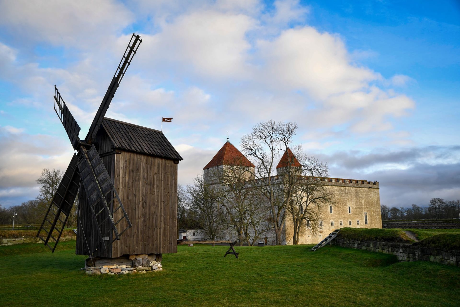
Kuressaare Castle
The episcopal castle at Kuressaare is one of the best-preserved medieval fortresses in the Baltic states and the only one I’ve seen that actually made me stop and look for a while. Built in the fourteenth century, it sits on a small promontory surrounded by a moat, accessed through a stone bridge. The walls are thick enough to feel impregnable even to a twenty-first century visitor with no particular military anxieties.
Inside, the museum covers the city’s layered history from the Stone Age to Soviet occupation without softening any of it. Outside, the fortifications are walkable — I spent a long time on the bastions looking over the water, watching swans ignore the history entirely.
The Kaali Crater
Nine kilometers from Kuressaare, the Kaali meteorite crater sits in a field so unassuming from the road that it’s easy to miss. A ring of trees on a slight rise, and then suddenly a lake inside a circular depression about a hundred meters across: this is what a meteorite impact looks like 7,500 years later. The water is dark and still. The surrounding terrain is completely ordinary farmland.
I found this combination — catastrophic event, total absorption into landscape — genuinely moving. The crater was probably still a sacred site in the Iron Age. Standing there, I could understand why. Something happened here that the land is still quietly holding.
Windmills and Coastal Villages
The windmills of Angla, near the northern coast, are the most photographed thing on Saaremaa: five traditional post mills on a hill above the road. I arrived in the afternoon when the light came from the west and turned the old timber a warm amber. They’re not operational. They haven’t been for decades. But they look exactly like they belong here, which is its own form of purpose.
The villages on Saaremaa’s western coast — Kihelkonna, Lümanda — are quiet enough to feel genuinely remote. I found a guesthouse run by a woman who brought herring and black bread for breakfast without asking what I wanted. This seemed correct.
When to go: May and June before peak season, when bird activity is high and tourist numbers manageable. August for beach weather at Mändjala. September for mushroom season — locals are serious about this — and a mellower island energy. The ferry runs year-round; winter is dramatic if cold.