
Lagoa do Fogo
"I waited three hours for the cloud to clear. It was not three hours wasted."
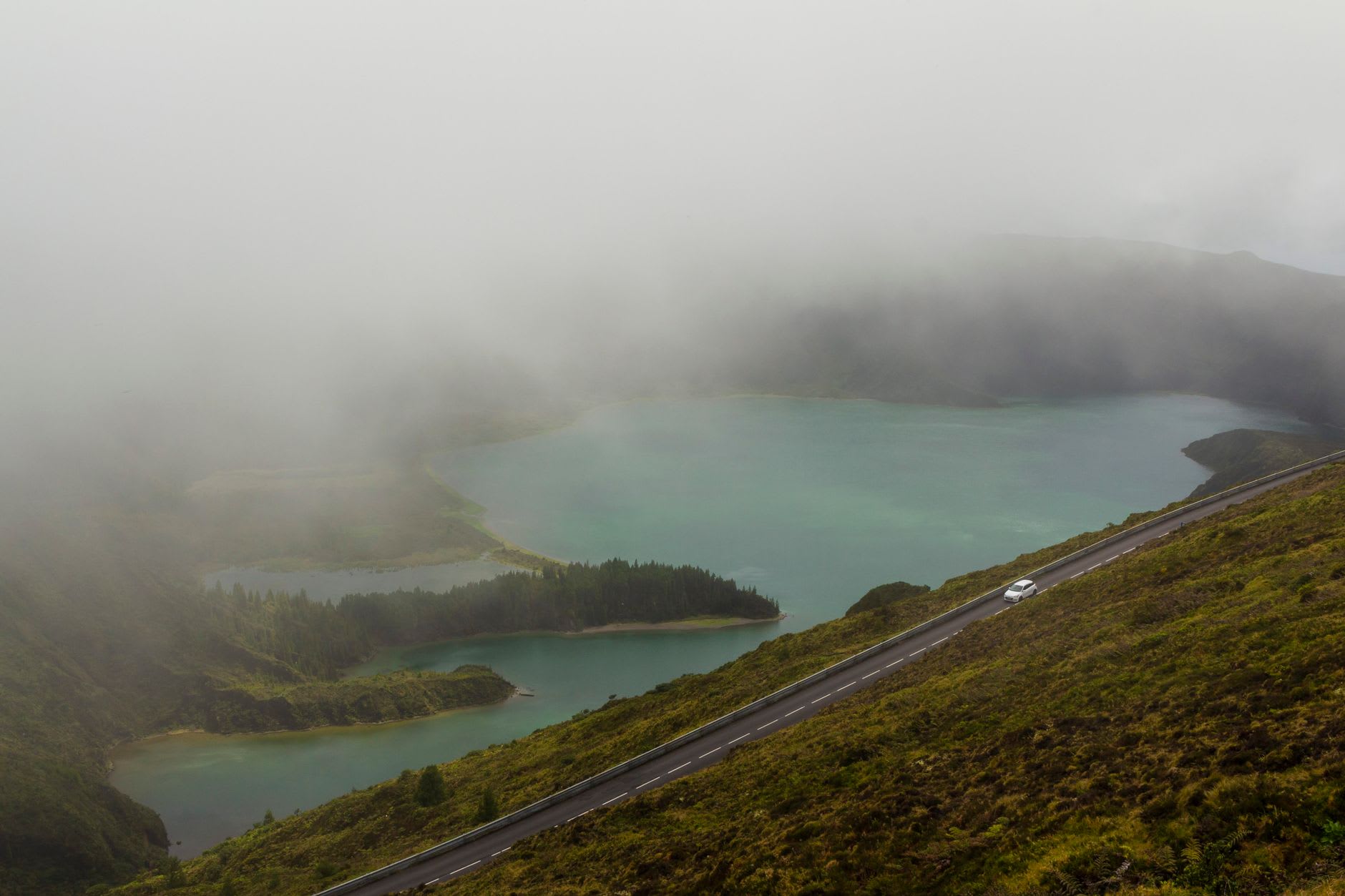
The road to Lagoa do Fogo climbs through three microclimates in about twenty minutes. You leave Ribeira Grande in coastal sunshine, pass through a band of eucalyptus forest in light mist, and emerge onto the crater rim in something closer to cloud than weather. On my first attempt, I could see nothing — the viewpoint was a wall of white, the lake theoretically somewhere below. I went back to Ponta Delgada and tried again the next morning, earlier, and found the cloud still thick but moving, tearing at its edges, and I waited.
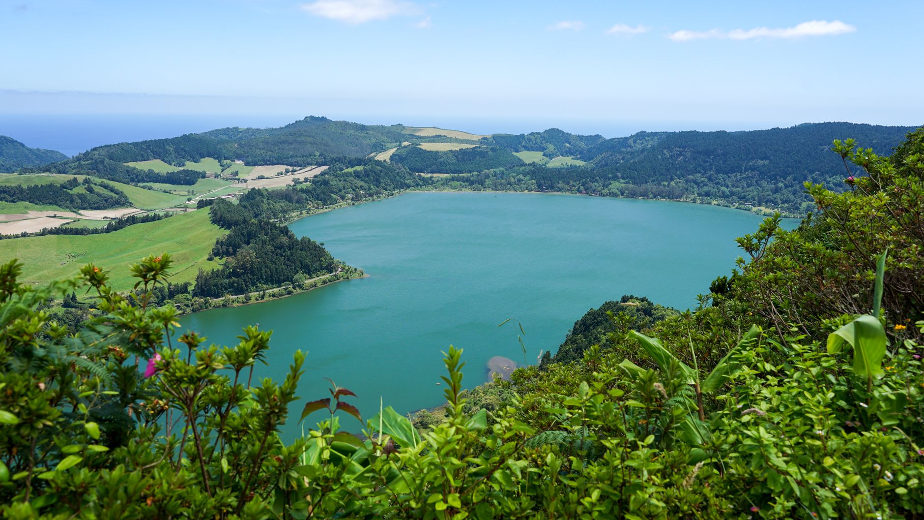
The clearing came in pieces. First a strip of dark water appeared through the mist, then the far crater wall, then in one quick unpacking of cloud the entire lake was there — the deepest blue I’ve seen in still water, ringed by slopes so steep and green they seem to lean over the surface. No buildings visible anywhere. No boats, no infrastructure — the lake sits inside a nature reserve and access to the shore is limited. The protection shows. It looks like a place that doesn’t know humans exist, which is the rarest quality a place can have in 2025.
The trail down to the water is steep — about forty minutes of descent on a path that turns to mud after rain, which is often, because the crater catches weather. I went down in rubber boots I’d borrowed from the guesthouse owner, a sensible man who had looked at my trail runners with an expression that said volumes. The vegetation on the descent is extraordinary: tree ferns, mosses, ferns in varieties I couldn’t count, everything dripping and prehistoric-feeling, and the air cooling as you lose altitude into the crater. The birds are loud here — chaffinches, goldcrests, the occasional blackbird — their calls bouncing off the crater walls with a clarity that comes from the total absence of road noise.
At the water’s edge, the lake is cold and glassy and seems impossibly deep. There’s a small black sand beach, the sand made from eroded volcanic rock, dark and fine. The swimming is allowed and the temperature is bracing — I stayed in for about five minutes, which was enough to understand why the clarity is so remarkable and also to feel deeply, cleanly cold. A coot regarded me from thirty metres out with the calm skepticism of a bird that has been here much longer than tourism.
The name — Fire Lake — comes not from the water’s colour but from the 1563 eruption that formed the surrounding caldera, one of the last major volcanic events on São Miguel before Furnas took that role in 1630. The geology here is recent by any standard, and standing on the crater rim you feel that recency: the slopes too sharp, the soil too dark, the vegetation somehow too intensive, as if the earth is still compensating for something.
From the rim on a clear day, you can see both coasts of São Miguel simultaneously — the island is only about sixty kilometres long — and the Atlantic on either side glinting at different angles. It’s the only place on the island where you understand the geography whole, and it reframes everything else you’ve seen.
When to go: May through October, and always early morning before cloud builds. Sunrise visits are unreliable but when they work, the lake in first light with mist rising from the cold water is something you won’t find the right word for. Bring waterproof boots and layers regardless of the forecast; the crater makes its own weather.