
Columbia River Gorge
"The wind came up the river like it had somewhere to be, and every waterfall we passed seemed to be leaning into it."
A dramatic river canyon carved through the Cascades where Oregon and Washington face each other across the wide Columbia. Waterfalls pour off basalt cliffs by the dozen, wind funnels through hard enough to lift a sailboard, and the light shifts from rainforest green to high-desert gold in the space of a single drive.
We started the day in fog so thick the river was only a rumor, and by afternoon we were squinting into hard gold light with the wind trying to take the map out of Lia’s hands. That is the Gorge in a sentence: it refuses to hold still. The Columbia has been sawing through the Cascade Range for longer than there have been mountains to saw, and the result is a corridor where the wet western forests and the dry eastern plateau meet and argue. You drive an hour and cross from one climate into another, the ferns giving way to sagebrush, the moss to bare rock.
The Waterfall Corridor
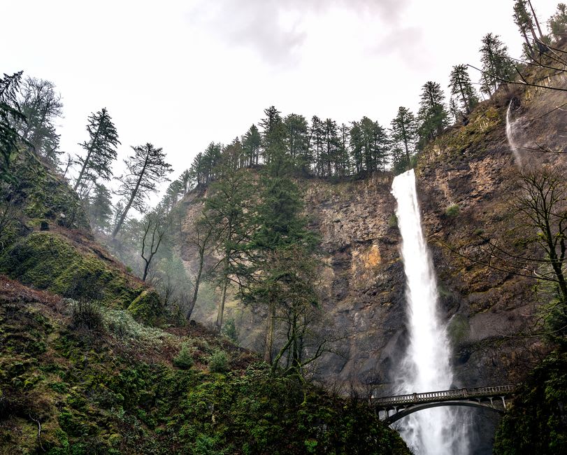
The old Historic Columbia River Highway is the way to do it — a narrow ribbon of 1910s engineering that loops away from the interstate and up into the cliffs where the waterfalls are. There are dozens. We stopped at so many that they began to blur, and then we came around a bend to Multnomah Falls and stopped blurring immediately. It drops six hundred feet in two tiers, with a stone footbridge slung across the gap between them, and the spray reaches you on the trail long before the falls do. We climbed to the bridge and stood in the cold breath of it, soaked and grinning, while the water thundered past close enough to touch. Lia said something and I couldn’t hear a word of it.

Vista House and the Wind
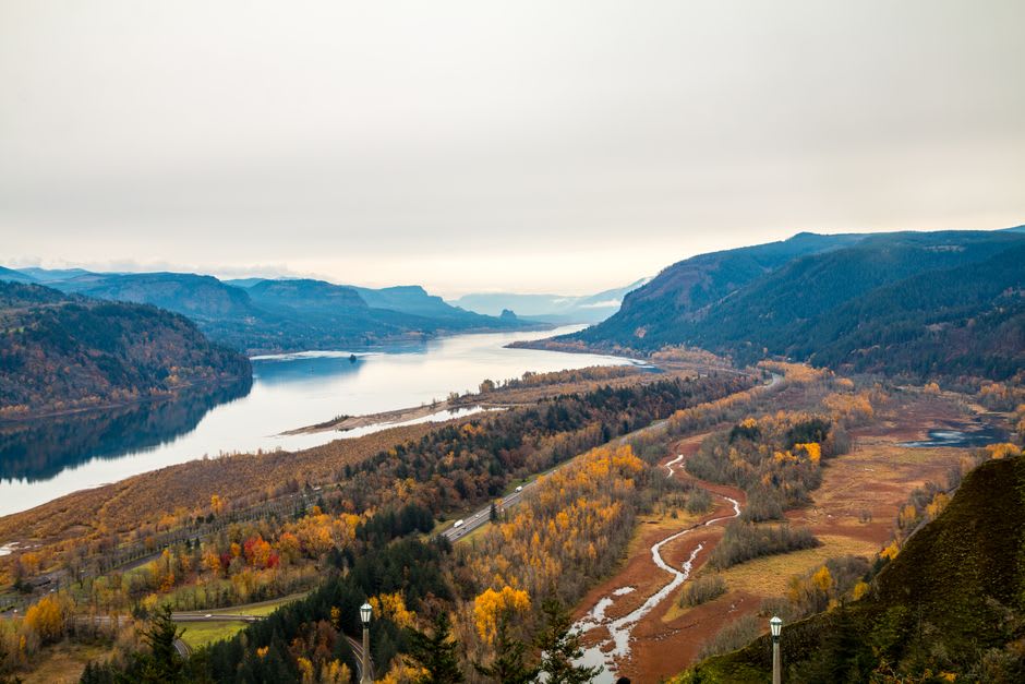
Higher up, on a promontory called Crown Point, stands Vista House — a round stone rotunda built a century ago as a rest stop for early motorists, and now mostly a place to be nearly knocked over by the wind. We could barely open the car doors. Inside, the marble hall was calm and echoing; outside, the gale came straight up the river and hit the building like a wall of water. From the parapet the whole Gorge unrolled westward, the Columbia flat and silver between its cliffs, the light doing something extraordinary to the ridgelines. This is the wind that made the place a mecca for windsurfers downriver at Hood River — we watched them later, bright sails skating the chop, using the same force that had tried to flatten us.
The Dry Side
By late afternoon we had driven east past the last of the firs and out onto the golden shoulder of the Gorge, where the hills go bare and rounded and the sky opens up. The transformation is almost comic in its abruptness — one minute rainforest, the next a landscape that could pass for Spain. We pulled over near Rowena and walked out along a bench of wildflowers above a great looping bend in the river, balsamroot blooming yellow all around us, the wind now warm instead of wet. A freight train crawled along the far bank, tiny against the cliffs, and its horn came to us thin and long across the water.
Getting There
The western end of the Gorge begins about thirty minutes east of Portland on I-84. Take the Historic Highway exit for the waterfall corridor and Vista House; the interstate runs the whole length below if you want to cover ground. Hood River, the windsurfing and cider hub, is roughly an hour out. Spring brings the fullest waterfalls and the wildflower blooms on the dry side; come on a weekday if you can, as Multnomah Falls draws crowds and now uses a timed-entry permit in peak summer.
Keep exploring
More of Oregon