Huaraz
"Huaraz sits between glaciers and the cloud line, and the altitude hits before the beauty does."
The gateway to the Cordillera Blanca, where Andean peaks above 6000m form the world's greatest tropical trekking.
The bus from Lima dropped us onto Jirón Luzuriaga at five in the morning, in a cold that smelled of woodsmoke and wet concrete. I stepped down onto the pavement, looked up, and saw nothing — just a dark sky pricked with stars at impossible proximity. The altitude doesn’t announce itself with drama. It announces itself as a mild headache behind the eyes, a faint reluctance in the lungs, a sense that your body is quietly renegotiating its terms.
Huaraz sits at 3,052 meters. The peaks around it — Huascarán, Chopicalqui, Artesonraju — push past 6,000. The city itself is unglamorous: rebuilt largely after the 1970 earthquake leveled most of the old colonial center, it has the utilitarian bones of a place that was reassembled in a hurry. Low concrete buildings, a market that spills across several blocks, a plaza de armas that functions more as a roundabout than a gathering place. None of that matters once you look up.
The Market and the Morning
The Mercado Central on Calle Cruz Romero is where I spent most mornings before any trekking logic kicked in. It opens before six and runs on a diesel of noise — vendors calling prices, propane burners hissing under enormous pots, the dry rustle of quinoa being poured into paper bags. I ate caldo de gallina at a long communal table, the broth dense and yellow with fat, a whole leg of hen submerged alongside fideos and a slice of potato that had absorbed everything. It cost three soles. Lia ordered the same and declared it the best thing she’d eaten in Peru, which felt like a strong claim until the bowl arrived and I understood completely.
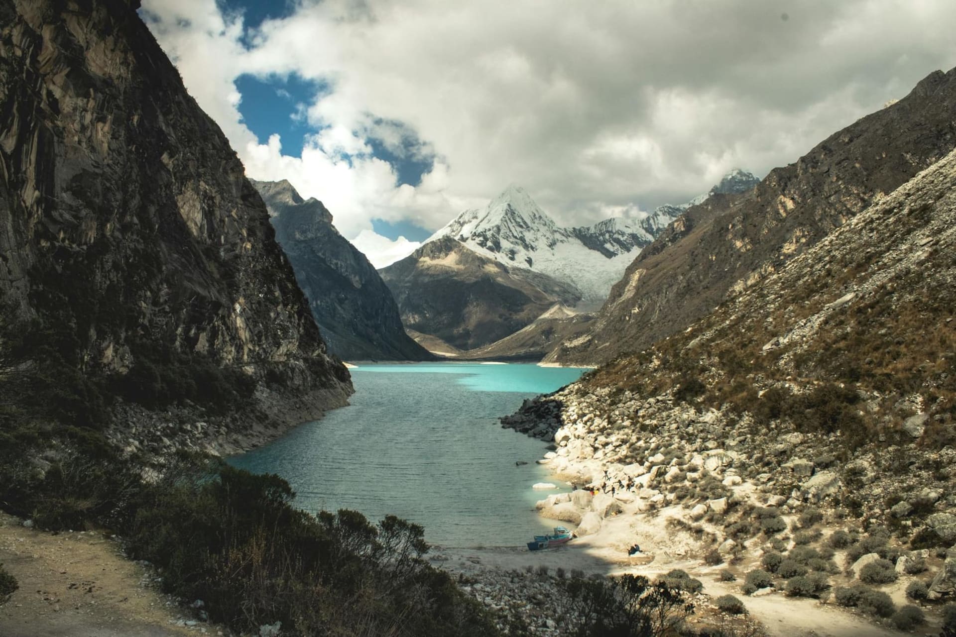
Into the Cordillera
The trekking infrastructure here is serious. Guiding agencies line the lower blocks of Luzuriaga; gear rental shops sit shoulder to shoulder. But what surprised me — genuinely caught me off guard — was the Laguna 69 trail on a Tuesday in low season. I expected solitude. What I found, at the turquoise lake itself, was a kind of stunned silence shared among strangers. A Swiss couple, a pair of Peruvian students from Lima, an older Japanese man hiking alone. Nobody spoke for several minutes. The water is a color that doesn’t have a convincing name in any language I know — somewhere between cyan and the inside of a glacier — and the peaks behind it rise so steeply they seem to lean forward.
Acclimatizing with Intention
Most itineraries suggest two full rest days before attempting anything serious. I’d push that to three. Walk slowly up to the Mirador de Rataquenua on the first afternoon — the views across the Callejón de Huaylas open in stages as you climb — and let the body catch up to the elevation at its own pace. The headache passes. The air starts to feel like enough.
When to go: The dry season runs May through September, with July and August offering the clearest skies and most stable conditions for high-altitude trekking. April and October are shoulder months — quieter, with occasional rain, but still viable for acclimatization hikes and day routes into the Cordillera.