Pacific
Marshall Islands
"I came expecting an island. I found a thread stitched between two oceans."
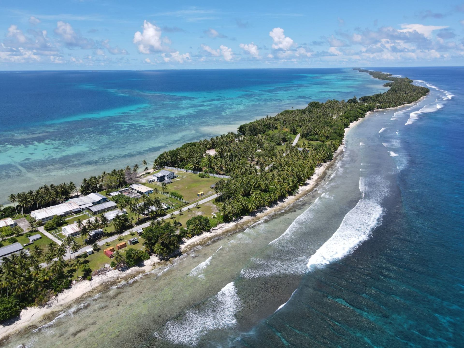
The plane descends for what feels like too long over open water before the runway at Majuro finally appears — and even then, you wonder if the pilot has made a mistake. The runway is the island. Or rather, the island is the runway, a strip of coral and coconut palms barely wide enough to fit a road on either side of the tarmac. On your left, the lagoon glows jade green. On your right, the Pacific heaves dark and serious. The Marshall Islands will tell you everything you need to know about itself in the first thirty seconds after landing.
What nobody prepares you for is the scale of the ocean here. This is not the Caribbean, where land is never far. The Marshalls are 29 atolls and 5 isolated islands spread across nearly two million square kilometers of the Central Pacific, with a total land area smaller than Washington D.C. The country is almost entirely water. The highest point is about two meters above sea level. That fact hits differently when you’re standing on it, watching the tide. I spent a week on Majuro and another on Arno Atoll, and I never entirely shook the feeling of floating — not in a romantic sense, but in a genuinely vertiginous one. The islands do not give you solid ground to stand on in any psychological sense.
The local food is simpler than you might expect: rice, canned fish, breadfruit when it’s in season, and the occasional plate of grilled yellowfin from someone’s morning catch. There’s a small Korean restaurant in Majuro that serves better bibimbap than I’ve had in Seoul, which makes no sense and yet makes perfect sense — the Pacific has always been a place where routes cross in unexpected ways. Marshallese people are warm in a way that feels unhurried, generous without performance. The culture carries deep scars from the US nuclear testing program at Bikini Atoll between 1946 and 1958, and from the slow-motion crisis of rising sea levels. People speak about both with a matter-of-factness that hits harder than outrage would.
When to go: November through April is the dry season and offers the most consistent weather. The water temperature hovers around 28°C year-round, and the lagoon visibility is best from January to March. Avoid peak typhoon season (July to October), though the Marshalls sit slightly south of the main typhoon belt and rarely take direct hits.
What most guides get wrong: They file the Marshall Islands under “off the beaten path” and call it a day, as if remoteness were the entire point. It isn’t. This is one of the only places on earth where climate change is not a future abstract but a present, physical reality you can observe with your own eyes — in the flooding during king tides, in the coral bleaching, in conversations with people who are already planning what displacement might look like for their children. Coming here without being willing to sit with that dimension is a way of missing the place entirely.